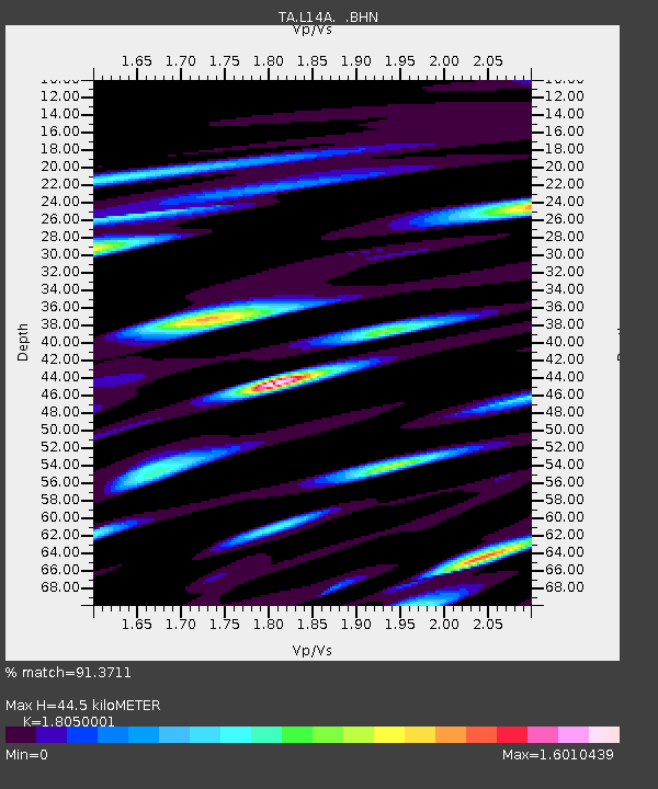
L14A Malta, ID, USA - Earthquake Result Viewer
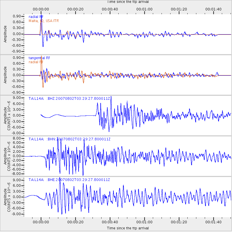
Earthquake location: Andreanof Islands, Aleutian Is.
Earthquake latitude/longitude: 51.3/-180.0
Earthquake time(UTC): 2007/08/02 (214) 03:21:42 GMT
Earthquake Depth: 21 km
Earthquake Magnitude: 6.3 MB, 6.6 MS, 6.7 MW, 6.6 MW
Earthquake Catalog/Contributor: WHDF/NEIC
Network: TA USArray Transportable Network (new EarthScope stations)
Station: L14A Malta, ID, USA
Lat/Lon: 42.03 N/113.24 W
Elevation: 1528 m
Distance: 45.2 deg
Az: 74.512 deg
Baz: 305.71 deg
Ray Param: 0.07137286
Estimated Moho Depth: 44.5 km
Estimated Crust Vp/Vs: 1.81
Assumed Crust Vp: 6.279 km/s
Estimated Crust Vs: 3.478 km/s
Estimated Crust Poisson's Ratio: 0.28
Radial Match: 91.3711 %
Radial Bump: 400
Transverse Match: 75.84123 %
Transverse Bump: 400
SOD ConfigId: 2564
Insert Time: 2010-03-06 15:02:39.232 +0000
GWidth: 2.5
Max Bumps: 400
Tol: 0.001

Signal To Noise

ChannelStoNSTALTA
TA:L14A: :BHN:20070802T03:29:27.800011Z4.6220951.6954122E-63.6680598E-7
TA:L14A: :BHE:20070802T03:29:27.800011Z2.81092621.4891582E-65.297749E-7
TA:L14A: :BHZ:20070802T03:29:27.800011Z6.68209272.6561254E-63.9749904E-7
Arrivals
Ps6.1 SECOND
PpPs19 SECOND
PsPs/PpSs25 SECOND