You are here: Home > Network List > TA - USArray Transportable Network (new EarthScope stations) Stations List
> Station A21K Barrow, AK, USA > Earthquake Result Viewer
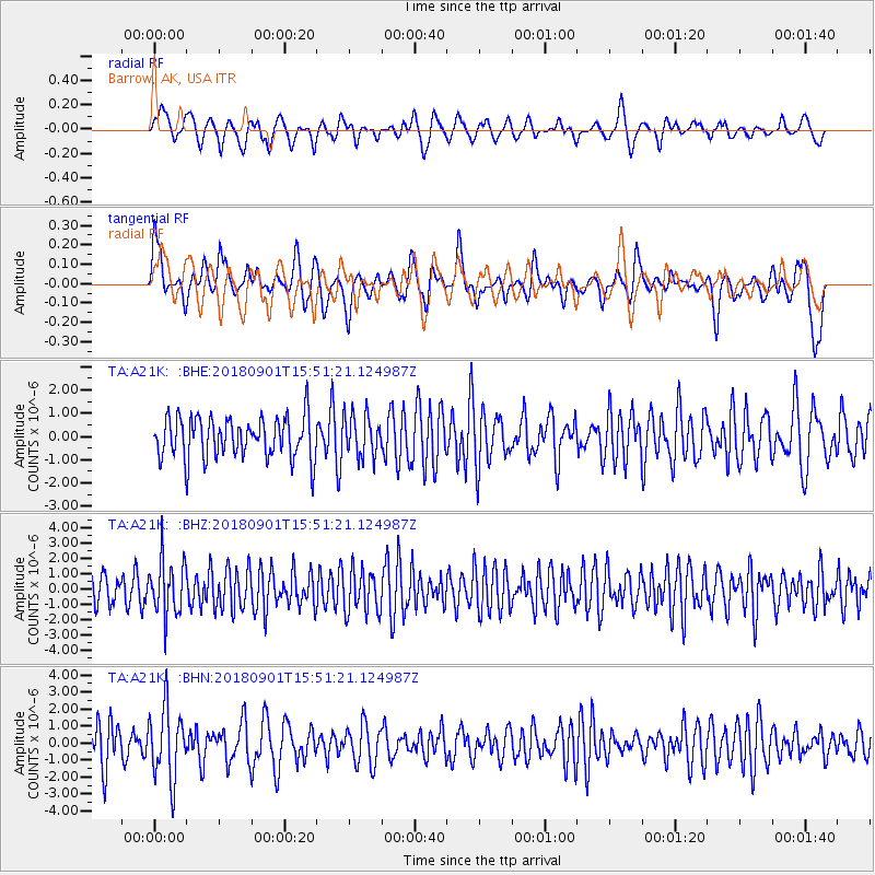
A21K Barrow, AK, USA - Earthquake Result Viewer
*The percent match for this event was below the threshold and hence no stack was calculated.
| Earthquake location: |
Bonin Islands, Japan Region |
| Earthquake latitude/longitude: |
27.9/139.9 |
| Earthquake time(UTC): |
2018/09/01 (244) 15:43:02 GMT |
| Earthquake Depth: |
455 km |
| Earthquake Magnitude: |
5.6 Mww |
| Earthquake Catalog/Contributor: |
NEIC PDE/us |
|
| Network: |
TA USArray Transportable Network (new EarthScope stations) |
| Station: |
A21K Barrow, AK, USA |
| Lat/Lon: |
71.32 N/156.62 W |
| Elevation: |
577 m |
|
| Distance: |
55.4 deg |
| Az: |
20.505 deg |
| Baz: |
254.166 deg |
| Ray Param: |
$rayparam |
*The percent match for this event was below the threshold and hence was not used in the summary stack. |
|
| Radial Match: |
46.862247 % |
| Radial Bump: |
400 |
| Transverse Match: |
40.518097 % |
| Transverse Bump: |
400 |
| SOD ConfigId: |
13570011 |
| Insert Time: |
2019-05-01 01:39:07.942 +0000 |
| GWidth: |
2.5 |
| Max Bumps: |
400 |
| Tol: |
0.001 |
|
Signal To Noise
| Channel | StoN | STA | LTA |
| TA:A21K: :BHZ:20180901T15:51:21.124987Z | 1.4997356 | 1.7413078E-6 | 1.1610765E-6 |
| TA:A21K: :BHN:20180901T15:51:21.124987Z | 1.867671 | 2.0531616E-6 | 1.0993165E-6 |
| TA:A21K: :BHE:20180901T15:51:21.124987Z | 1.00292 | 9.015774E-7 | 8.9895246E-7 |
| Arrivals |
| Ps | |
| PpPs | |
| PsPs/PpSs | |


