You are here: Home > Network List > TA - USArray Transportable Network (new EarthScope stations) Stations List
> Station D25K Kavik River, AK, USA > Earthquake Result Viewer
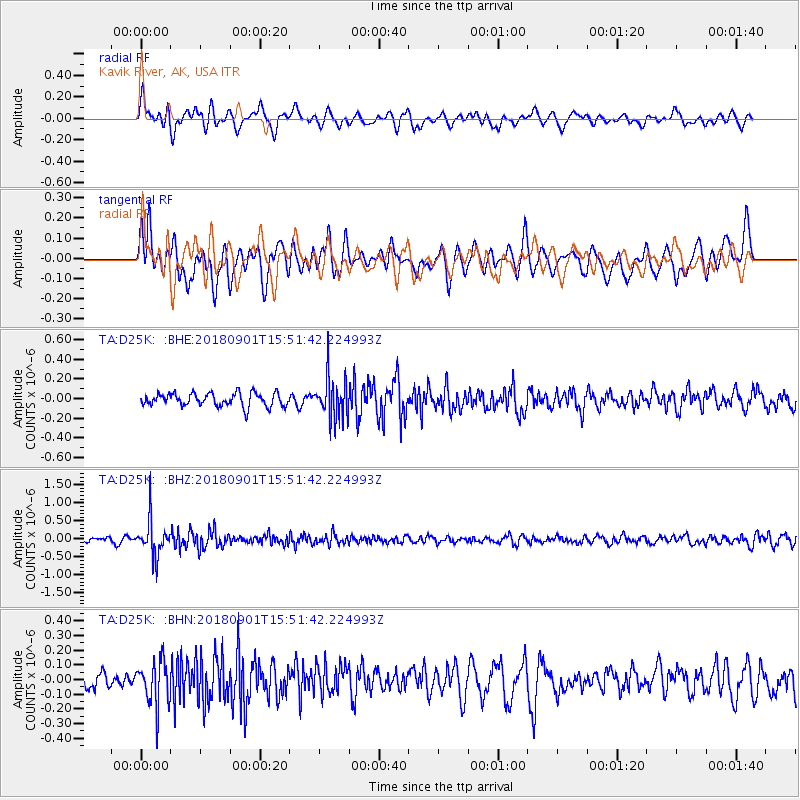
D25K Kavik River, AK, USA - Earthquake Result Viewer
*The percent match for this event was below the threshold and hence no stack was calculated.
| Earthquake location: |
Bonin Islands, Japan Region |
| Earthquake latitude/longitude: |
27.9/139.9 |
| Earthquake time(UTC): |
2018/09/01 (244) 15:43:02 GMT |
| Earthquake Depth: |
455 km |
| Earthquake Magnitude: |
5.6 Mww |
| Earthquake Catalog/Contributor: |
NEIC PDE/us |
|
| Network: |
TA USArray Transportable Network (new EarthScope stations) |
| Station: |
D25K Kavik River, AK, USA |
| Lat/Lon: |
69.32 N/146.38 W |
| Elevation: |
770 m |
|
| Distance: |
58.4 deg |
| Az: |
23.589 deg |
| Baz: |
265.493 deg |
| Ray Param: |
$rayparam |
*The percent match for this event was below the threshold and hence was not used in the summary stack. |
|
| Radial Match: |
65.28262 % |
| Radial Bump: |
400 |
| Transverse Match: |
60.06589 % |
| Transverse Bump: |
400 |
| SOD ConfigId: |
13570011 |
| Insert Time: |
2019-05-01 01:39:20.058 +0000 |
| GWidth: |
2.5 |
| Max Bumps: |
400 |
| Tol: |
0.001 |
|
Signal To Noise
| Channel | StoN | STA | LTA |
| TA:D25K: :BHZ:20180901T15:51:42.224993Z | 6.9207373 | 4.928789E-7 | 7.1217684E-8 |
| TA:D25K: :BHN:20180901T15:51:42.224993Z | 1.9324788 | 1.5063743E-7 | 7.795037E-8 |
| TA:D25K: :BHE:20180901T15:51:42.224993Z | 3.13116 | 2.1093126E-7 | 6.7365214E-8 |
| Arrivals |
| Ps | |
| PpPs | |
| PsPs/PpSs | |


