You are here: Home > Network List > TA - USArray Transportable Network (new EarthScope stations) Stations List
> Station E20K Nigu River, AK, USA > Earthquake Result Viewer
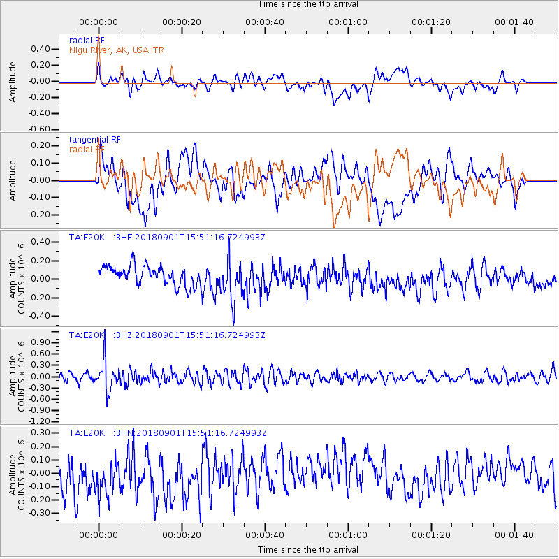
E20K Nigu River, AK, USA - Earthquake Result Viewer
*The percent match for this event was below the threshold and hence no stack was calculated.
| Earthquake location: |
Bonin Islands, Japan Region |
| Earthquake latitude/longitude: |
27.9/139.9 |
| Earthquake time(UTC): |
2018/09/01 (244) 15:43:02 GMT |
| Earthquake Depth: |
455 km |
| Earthquake Magnitude: |
5.6 Mww |
| Earthquake Catalog/Contributor: |
NEIC PDE/us |
|
| Network: |
TA USArray Transportable Network (new EarthScope stations) |
| Station: |
E20K Nigu River, AK, USA |
| Lat/Lon: |
68.26 N/156.19 W |
| Elevation: |
866 m |
|
| Distance: |
54.7 deg |
| Az: |
24.188 deg |
| Baz: |
256.679 deg |
| Ray Param: |
$rayparam |
*The percent match for this event was below the threshold and hence was not used in the summary stack. |
|
| Radial Match: |
37.973167 % |
| Radial Bump: |
400 |
| Transverse Match: |
40.530624 % |
| Transverse Bump: |
400 |
| SOD ConfigId: |
13570011 |
| Insert Time: |
2019-05-01 01:39:23.643 +0000 |
| GWidth: |
2.5 |
| Max Bumps: |
400 |
| Tol: |
0.001 |
|
Signal To Noise
| Channel | StoN | STA | LTA |
| TA:E20K: :BHZ:20180901T15:51:16.724993Z | 5.2711987 | 3.908242E-7 | 7.414333E-8 |
| TA:E20K: :BHN:20180901T15:51:16.724993Z | 1.2748768 | 2.0929264E-7 | 1.6416695E-7 |
| TA:E20K: :BHE:20180901T15:51:16.724993Z | 2.195312 | 2.2305245E-7 | 1.0160398E-7 |
| Arrivals |
| Ps | |
| PpPs | |
| PsPs/PpSs | |


