You are here: Home > Network List > TA - USArray Transportable Network (new EarthScope stations) Stations List
> Station I17K Unalakleet, AK, USA > Earthquake Result Viewer
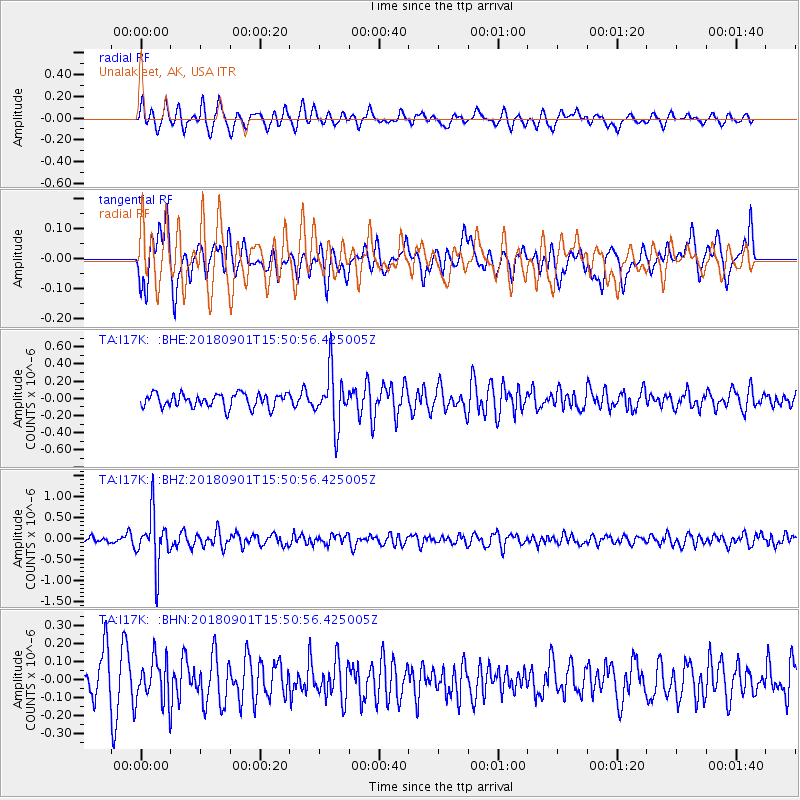
I17K Unalakleet, AK, USA - Earthquake Result Viewer
*The percent match for this event was below the threshold and hence no stack was calculated.
| Earthquake location: |
Bonin Islands, Japan Region |
| Earthquake latitude/longitude: |
27.9/139.9 |
| Earthquake time(UTC): |
2018/09/01 (244) 15:43:02 GMT |
| Earthquake Depth: |
455 km |
| Earthquake Magnitude: |
5.6 Mww |
| Earthquake Catalog/Contributor: |
NEIC PDE/us |
|
| Network: |
TA USArray Transportable Network (new EarthScope stations) |
| Station: |
I17K Unalakleet, AK, USA |
| Lat/Lon: |
63.89 N/160.70 W |
| Elevation: |
105 m |
|
| Distance: |
51.9 deg |
| Az: |
28.946 deg |
| Baz: |
255.406 deg |
| Ray Param: |
$rayparam |
*The percent match for this event was below the threshold and hence was not used in the summary stack. |
|
| Radial Match: |
66.7579 % |
| Radial Bump: |
400 |
| Transverse Match: |
47.110844 % |
| Transverse Bump: |
400 |
| SOD ConfigId: |
13570011 |
| Insert Time: |
2019-05-01 01:40:02.678 +0000 |
| GWidth: |
2.5 |
| Max Bumps: |
400 |
| Tol: |
0.001 |
|
Signal To Noise
| Channel | StoN | STA | LTA |
| TA:I17K: :BHZ:20180901T15:50:56.425005Z | 5.5591836 | 6.190841E-7 | 1.1136241E-7 |
| TA:I17K: :BHN:20180901T15:50:56.425005Z | 1.3586886 | 1.1860112E-7 | 8.729088E-8 |
| TA:I17K: :BHE:20180901T15:50:56.425005Z | 3.8524108 | 3.086388E-7 | 8.0115754E-8 |
| Arrivals |
| Ps | |
| PpPs | |
| PsPs/PpSs | |


