You are here: Home > Network List > TA - USArray Transportable Network (new EarthScope stations) Stations List
> Station I30M Mount Dempster, Yukon, CAN > Earthquake Result Viewer
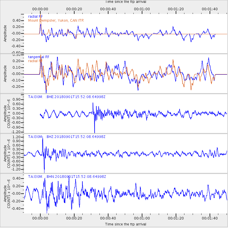
I30M Mount Dempster, Yukon, CAN - Earthquake Result Viewer
*The percent match for this event was below the threshold and hence no stack was calculated.
| Earthquake location: |
Bonin Islands, Japan Region |
| Earthquake latitude/longitude: |
27.9/139.9 |
| Earthquake time(UTC): |
2018/09/01 (244) 15:43:02 GMT |
| Earthquake Depth: |
455 km |
| Earthquake Magnitude: |
5.6 Mww |
| Earthquake Catalog/Contributor: |
NEIC PDE/us |
|
| Network: |
TA USArray Transportable Network (new EarthScope stations) |
| Station: |
I30M Mount Dempster, Yukon, CAN |
| Lat/Lon: |
65.22 N/136.38 W |
| Elevation: |
1399 m |
|
| Distance: |
62.4 deg |
| Az: |
28.21 deg |
| Baz: |
277.0 deg |
| Ray Param: |
$rayparam |
*The percent match for this event was below the threshold and hence was not used in the summary stack. |
|
| Radial Match: |
52.132835 % |
| Radial Bump: |
400 |
| Transverse Match: |
56.735825 % |
| Transverse Bump: |
400 |
| SOD ConfigId: |
13570011 |
| Insert Time: |
2019-05-01 01:40:08.900 +0000 |
| GWidth: |
2.5 |
| Max Bumps: |
400 |
| Tol: |
0.001 |
|
Signal To Noise
| Channel | StoN | STA | LTA |
| TA:I30M: :BHZ:20180901T15:52:08.64998Z | 4.983085 | 4.262855E-7 | 8.55465E-8 |
| TA:I30M: :BHN:20180901T15:52:08.64998Z | 1.9174551 | 2.133626E-7 | 1.1127385E-7 |
| TA:I30M: :BHE:20180901T15:52:08.64998Z | 2.2903044 | 3.0770514E-7 | 1.3435118E-7 |
| Arrivals |
| Ps | |
| PpPs | |
| PsPs/PpSs | |


