You are here: Home > Network List > TA - USArray Transportable Network (new EarthScope stations) Stations List
> Station M11K Mekoryuk, AK, USA > Earthquake Result Viewer
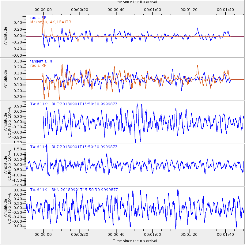
M11K Mekoryuk, AK, USA - Earthquake Result Viewer
*The percent match for this event was below the threshold and hence no stack was calculated.
| Earthquake location: |
Bonin Islands, Japan Region |
| Earthquake latitude/longitude: |
27.9/139.9 |
| Earthquake time(UTC): |
2018/09/01 (244) 15:43:02 GMT |
| Earthquake Depth: |
455 km |
| Earthquake Magnitude: |
5.6 Mww |
| Earthquake Catalog/Contributor: |
NEIC PDE/us |
|
| Network: |
TA USArray Transportable Network (new EarthScope stations) |
| Station: |
M11K Mekoryuk, AK, USA |
| Lat/Lon: |
60.38 N/166.20 W |
| Elevation: |
3.0 m |
|
| Distance: |
48.4 deg |
| Az: |
32.42 deg |
| Baz: |
252.77 deg |
| Ray Param: |
$rayparam |
*The percent match for this event was below the threshold and hence was not used in the summary stack. |
|
| Radial Match: |
53.0874 % |
| Radial Bump: |
400 |
| Transverse Match: |
51.18774 % |
| Transverse Bump: |
400 |
| SOD ConfigId: |
13570011 |
| Insert Time: |
2019-05-01 01:40:29.104 +0000 |
| GWidth: |
2.5 |
| Max Bumps: |
400 |
| Tol: |
0.001 |
|
Signal To Noise
| Channel | StoN | STA | LTA |
| TA:M11K: :BHZ:20180901T15:50:30.999987Z | 2.4655485 | 7.0607723E-7 | 2.8637734E-7 |
| TA:M11K: :BHN:20180901T15:50:30.999987Z | 1.3604083 | 3.020024E-7 | 2.2199393E-7 |
| TA:M11K: :BHE:20180901T15:50:30.999987Z | 0.88716656 | 3.5071673E-7 | 3.9532233E-7 |
| Arrivals |
| Ps | |
| PpPs | |
| PsPs/PpSs | |


