You are here: Home > Network List > TA - USArray Transportable Network (new EarthScope stations) Stations List
> Station O17K Koliganek, Bristol Bay, AK, USA > Earthquake Result Viewer
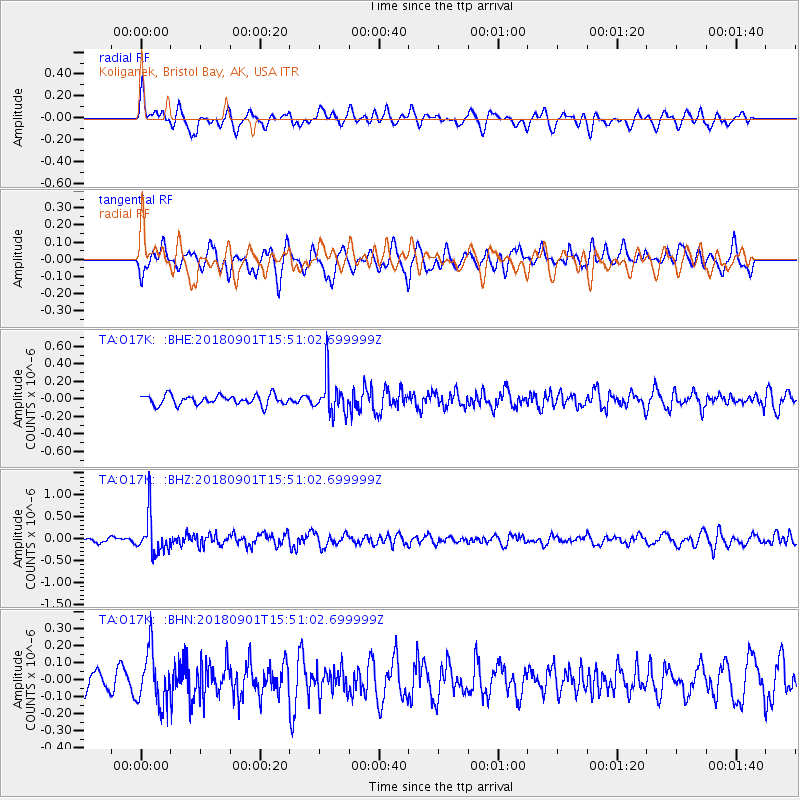
O17K Koliganek, Bristol Bay, AK, USA - Earthquake Result Viewer
*The percent match for this event was below the threshold and hence no stack was calculated.
| Earthquake location: |
Bonin Islands, Japan Region |
| Earthquake latitude/longitude: |
27.9/139.9 |
| Earthquake time(UTC): |
2018/09/01 (244) 15:43:02 GMT |
| Earthquake Depth: |
455 km |
| Earthquake Magnitude: |
5.6 Mww |
| Earthquake Catalog/Contributor: |
NEIC PDE/us |
|
| Network: |
TA USArray Transportable Network (new EarthScope stations) |
| Station: |
O17K Koliganek, Bristol Bay, AK, USA |
| Lat/Lon: |
59.77 N/157.09 W |
| Elevation: |
156 m |
|
| Distance: |
52.7 deg |
| Az: |
34.483 deg |
| Baz: |
261.965 deg |
| Ray Param: |
$rayparam |
*The percent match for this event was below the threshold and hence was not used in the summary stack. |
|
| Radial Match: |
62.33273 % |
| Radial Bump: |
400 |
| Transverse Match: |
55.703438 % |
| Transverse Bump: |
377 |
| SOD ConfigId: |
13570011 |
| Insert Time: |
2019-05-01 01:40:51.702 +0000 |
| GWidth: |
2.5 |
| Max Bumps: |
400 |
| Tol: |
0.001 |
|
Signal To Noise
| Channel | StoN | STA | LTA |
| TA:O17K: :BHZ:20180901T15:51:02.699999Z | 6.200222 | 4.4661317E-7 | 7.20318E-8 |
| TA:O17K: :BHN:20180901T15:51:02.699999Z | 2.5746253 | 1.5664219E-7 | 6.084077E-8 |
| TA:O17K: :BHE:20180901T15:51:02.699999Z | 3.8683715 | 2.1384288E-7 | 5.527982E-8 |
| Arrivals |
| Ps | |
| PpPs | |
| PsPs/PpSs | |


