You are here: Home > Network List > UW - Pacific Northwest Regional Seismic Network Stations List
> Station UMAT Pilot Rock, OR, USA > Earthquake Result Viewer
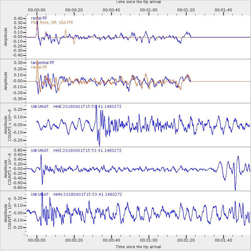
UMAT Pilot Rock, OR, USA - Earthquake Result Viewer
*The percent match for this event was below the threshold and hence no stack was calculated.
| Earthquake location: |
Bonin Islands, Japan Region |
| Earthquake latitude/longitude: |
27.9/139.9 |
| Earthquake time(UTC): |
2018/09/01 (244) 15:43:02 GMT |
| Earthquake Depth: |
455 km |
| Earthquake Magnitude: |
5.6 Mww |
| Earthquake Catalog/Contributor: |
NEIC PDE/us |
|
| Network: |
UW Pacific Northwest Regional Seismic Network |
| Station: |
UMAT Pilot Rock, OR, USA |
| Lat/Lon: |
45.29 N/118.96 W |
| Elevation: |
1318 m |
|
| Distance: |
77.9 deg |
| Az: |
45.109 deg |
| Baz: |
297.368 deg |
| Ray Param: |
$rayparam |
*The percent match for this event was below the threshold and hence was not used in the summary stack. |
|
| Radial Match: |
71.65703 % |
| Radial Bump: |
400 |
| Transverse Match: |
55.84451 % |
| Transverse Bump: |
389 |
| SOD ConfigId: |
13570011 |
| Insert Time: |
2019-05-01 01:42:22.608 +0000 |
| GWidth: |
2.5 |
| Max Bumps: |
400 |
| Tol: |
0.001 |
|
Signal To Noise
| Channel | StoN | STA | LTA |
| UW:UMAT: :HHZ:20180901T15:53:41.148027Z | 4.5059266 | 2.40707E-7 | 5.342009E-8 |
| UW:UMAT: :HHN:20180901T15:53:41.148027Z | 1.7408004 | 9.83916E-8 | 5.65209E-8 |
| UW:UMAT: :HHE:20180901T15:53:41.148027Z | 2.8289335 | 1.2672172E-7 | 4.479487E-8 |
| Arrivals |
| Ps | |
| PpPs | |
| PsPs/PpSs | |


