You are here: Home > Network List > TA - USArray Transportable Network (new EarthScope stations) Stations List
> Station L14A Malta, ID, USA > Earthquake Result Viewer
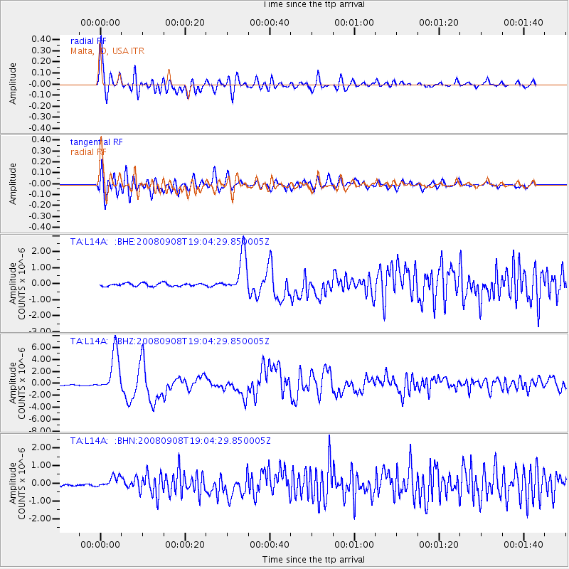
L14A Malta, ID, USA - Earthquake Result Viewer
*The percent match for this event was below the threshold and hence no stack was calculated.
| Earthquake location: |
Vanuatu Islands |
| Earthquake latitude/longitude: |
-13.5/167.0 |
| Earthquake time(UTC): |
2008/09/08 (252) 18:52:06 GMT |
| Earthquake Depth: |
110 km |
| Earthquake Magnitude: |
6.4 MB, 6.9 MW, 6.9 MW |
| Earthquake Catalog/Contributor: |
WHDF/NEIC |
|
| Network: |
TA USArray Transportable Network (new EarthScope stations) |
| Station: |
L14A Malta, ID, USA |
| Lat/Lon: |
42.03 N/113.24 W |
| Elevation: |
1528 m |
|
| Distance: |
91.5 deg |
| Az: |
47.176 deg |
| Baz: |
253.267 deg |
| Ray Param: |
$rayparam |
*The percent match for this event was below the threshold and hence was not used in the summary stack. |
|
| Radial Match: |
89.5365 % |
| Radial Bump: |
400 |
| Transverse Match: |
90.147316 % |
| Transverse Bump: |
400 |
| SOD ConfigId: |
2560 |
| Insert Time: |
2010-03-06 15:05:12.789 +0000 |
| GWidth: |
2.5 |
| Max Bumps: |
400 |
| Tol: |
0.001 |
|
Signal To Noise
| Channel | StoN | STA | LTA |
| TA:L14A: :BHZ:20080908T19:04:29.850005Z | 36.054764 | 3.5128912E-6 | 9.74321E-8 |
| TA:L14A: :BHN:20080908T19:04:29.850005Z | 3.2893777 | 3.1400475E-7 | 9.546023E-8 |
| TA:L14A: :BHE:20080908T19:04:29.850005Z | 13.577588 | 1.2482525E-6 | 9.193477E-8 |
| Arrivals |
| Ps | |
| PpPs | |
| PsPs/PpSs | |


