You are here: Home > Network List > GS - US Geological Survey Networks Stations List
> Station DEC06 Boomer > Earthquake Result Viewer
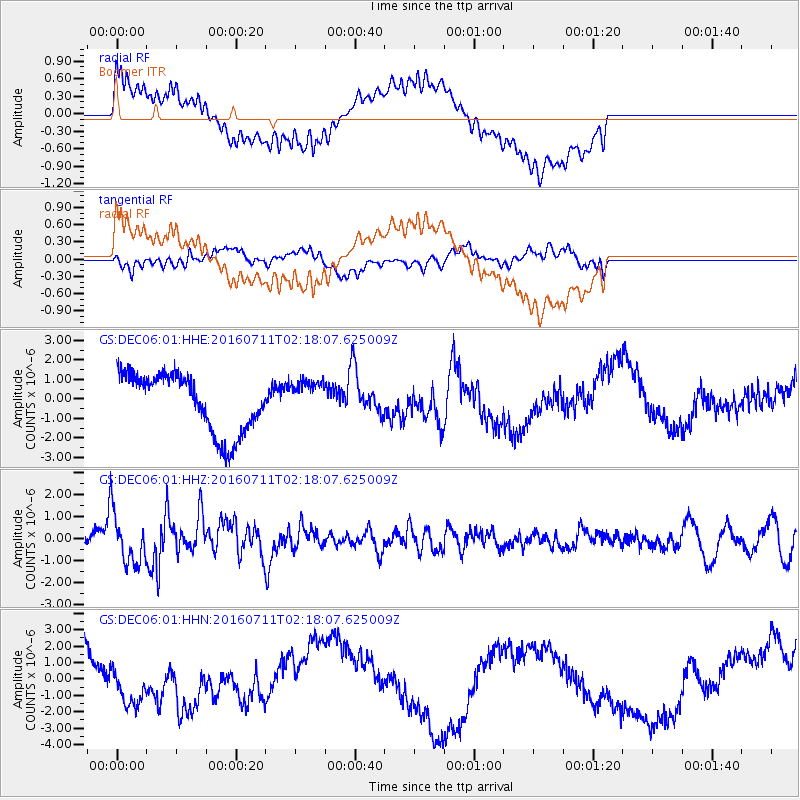
DEC06 Boomer - Earthquake Result Viewer
*The percent match for this event was below the threshold and hence no stack was calculated.
| Earthquake location: |
Near Coast Of Ecuador |
| Earthquake latitude/longitude: |
0.6/-79.7 |
| Earthquake time(UTC): |
2016/07/11 (193) 02:11:04 GMT |
| Earthquake Depth: |
19 km |
| Earthquake Magnitude: |
6.3 MWW, 6.3 MWC, 6.3 MWB |
| Earthquake Catalog/Contributor: |
NEIC PDE/NEIC COMCAT |
|
| Network: |
GS US Geological Survey Networks |
| Station: |
DEC06 Boomer |
| Lat/Lon: |
39.90 N/88.95 W |
| Elevation: |
215 m |
|
| Distance: |
40.1 deg |
| Az: |
348.882 deg |
| Baz: |
165.485 deg |
| Ray Param: |
$rayparam |
*The percent match for this event was below the threshold and hence was not used in the summary stack. |
|
| Radial Match: |
43.7386 % |
| Radial Bump: |
400 |
| Transverse Match: |
48.875896 % |
| Transverse Bump: |
400 |
| SOD ConfigId: |
1634031 |
| Insert Time: |
2016-07-25 02:26:33.261 +0000 |
| GWidth: |
2.5 |
| Max Bumps: |
400 |
| Tol: |
0.001 |
|
Signal To Noise
| Channel | StoN | STA | LTA |
| GS:DEC06:01:HHZ:20160711T02:18:07.625009Z | 3.6835232 | 1.1199224E-6 | 3.0403567E-7 |
| GS:DEC06:01:HHN:20160711T02:18:07.625009Z | 0.51690316 | 1.095797E-6 | 2.1199269E-6 |
| GS:DEC06:01:HHE:20160711T02:18:07.625009Z | 0.62562716 | 9.4034704E-7 | 1.5030469E-6 |
| Arrivals |
| Ps | |
| PpPs | |
| PsPs/PpSs | |


