You are here: Home > Network List > TA - USArray Transportable Network (new EarthScope stations) Stations List
> Station O17A Robinson Place, Fruitland, UT, USA > Earthquake Result Viewer
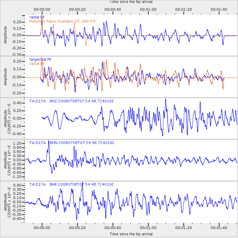
O17A Robinson Place, Fruitland, UT, USA - Earthquake Result Viewer
*The percent match for this event was below the threshold and hence no stack was calculated.
| Earthquake location: |
Ryukyu Islands, Japan |
| Earthquake latitude/longitude: |
27.5/128.3 |
| Earthquake time(UTC): |
2008/07/08 (190) 07:42:10 GMT |
| Earthquake Depth: |
43 km |
| Earthquake Magnitude: |
6.0 MB, 5.5 MS, 6.0 MW, 6.0 MW |
| Earthquake Catalog/Contributor: |
WHDF/NEIC |
|
| Network: |
TA USArray Transportable Network (new EarthScope stations) |
| Station: |
O17A Robinson Place, Fruitland, UT, USA |
| Lat/Lon: |
40.19 N/110.74 W |
| Elevation: |
2079 m |
|
| Distance: |
93.1 deg |
| Az: |
41.15 deg |
| Baz: |
310.282 deg |
| Ray Param: |
$rayparam |
*The percent match for this event was below the threshold and hence was not used in the summary stack. |
|
| Radial Match: |
69.84471 % |
| Radial Bump: |
400 |
| Transverse Match: |
74.771805 % |
| Transverse Bump: |
400 |
| SOD ConfigId: |
2504 |
| Insert Time: |
2010-03-06 15:06:53.301 +0000 |
| GWidth: |
2.5 |
| Max Bumps: |
400 |
| Tol: |
0.001 |
|
Signal To Noise
| Channel | StoN | STA | LTA |
| TA:O17A: :BHN:20080708T07:54:48.724019Z | 4.8836565 | 4.902346E-7 | 1.003827E-7 |
| TA:O17A: :BHE:20080708T07:54:48.724019Z | 1.8138144 | 7.2435164E-8 | 3.9935266E-8 |
| TA:O17A: :BHZ:20080708T07:54:48.724019Z | 1.3112125 | 1.2493071E-7 | 9.5278764E-8 |
| Arrivals |
| Ps | |
| PpPs | |
| PsPs/PpSs | |


