You are here: Home > Network List > TA - USArray Transportable Network (new EarthScope stations) Stations List
> Station O17A Robinson Place, Fruitland, UT, USA > Earthquake Result Viewer
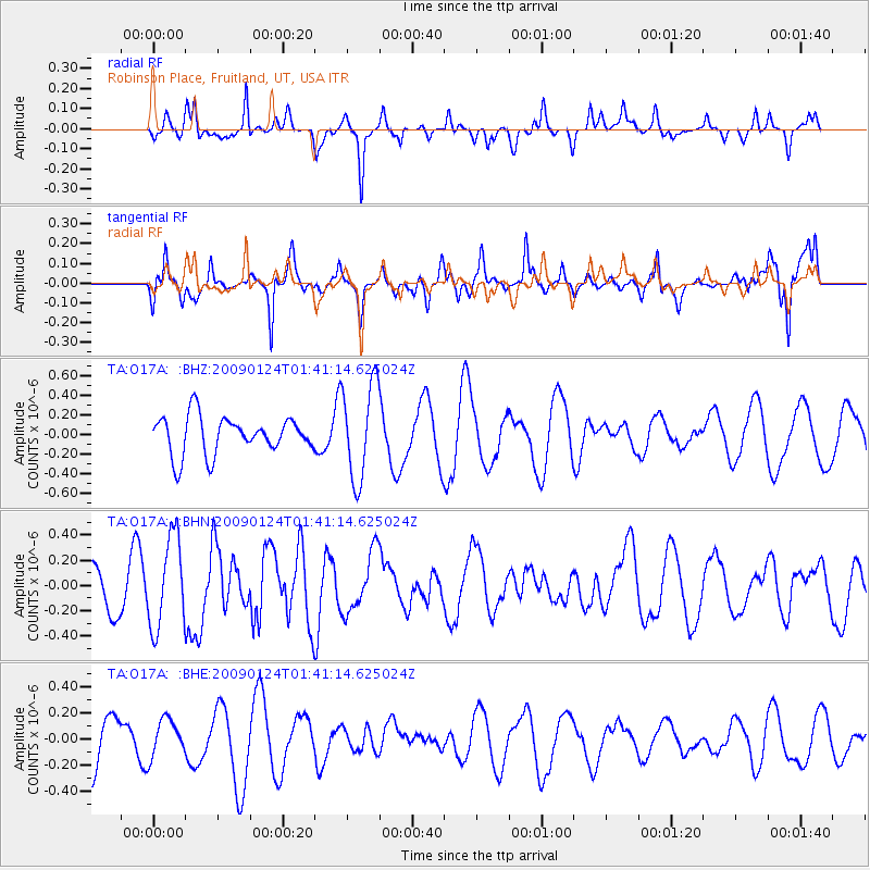
O17A Robinson Place, Fruitland, UT, USA - Earthquake Result Viewer
*The percent match for this event was below the threshold and hence no stack was calculated.
| Earthquake location: |
Kermadec Islands Region |
| Earthquake latitude/longitude: |
-28.2/-176.7 |
| Earthquake time(UTC): |
2009/01/24 (024) 01:28:39 GMT |
| Earthquake Depth: |
10 km |
| Earthquake Magnitude: |
5.5 MB, 5.8 MS, 6.0 MW, 5.8 MW |
| Earthquake Catalog/Contributor: |
WHDF/NEIC |
|
| Network: |
TA USArray Transportable Network (new EarthScope stations) |
| Station: |
O17A Robinson Place, Fruitland, UT, USA |
| Lat/Lon: |
40.19 N/110.74 W |
| Elevation: |
2079 m |
|
| Distance: |
91.6 deg |
| Az: |
44.411 deg |
| Baz: |
233.706 deg |
| Ray Param: |
$rayparam |
*The percent match for this event was below the threshold and hence was not used in the summary stack. |
|
| Radial Match: |
47.084515 % |
| Radial Bump: |
252 |
| Transverse Match: |
58.439243 % |
| Transverse Bump: |
392 |
| SOD ConfigId: |
2658 |
| Insert Time: |
2010-03-06 15:07:21.352 +0000 |
| GWidth: |
2.5 |
| Max Bumps: |
400 |
| Tol: |
0.001 |
|
Signal To Noise
| Channel | StoN | STA | LTA |
| TA:O17A: :BHN:20090124T01:41:14.625024Z | 1.7346247 | 3.6015632E-7 | 2.076278E-7 |
| TA:O17A: :BHE:20090124T01:41:14.625024Z | 0.4225901 | 1.4875828E-7 | 3.5201552E-7 |
| TA:O17A: :BHZ:20090124T01:41:14.625024Z | 2.569112 | 4.914135E-7 | 1.9127756E-7 |
| Arrivals |
| Ps | |
| PpPs | |
| PsPs/PpSs | |


