You are here: Home > Network List > TA - USArray Transportable Network (new EarthScope stations) Stations List
> Station O17A Robinson Place, Fruitland, UT, USA > Earthquake Result Viewer
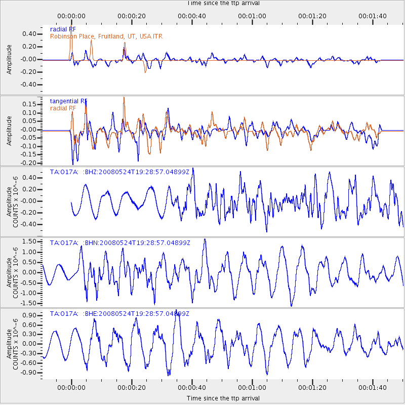
O17A Robinson Place, Fruitland, UT, USA - Earthquake Result Viewer
*The percent match for this event was below the threshold and hence no stack was calculated.
| Earthquake location: |
Colombia |
| Earthquake latitude/longitude: |
4.3/-73.8 |
| Earthquake time(UTC): |
2008/05/24 (145) 19:20:42 GMT |
| Earthquake Depth: |
8.9 km |
| Earthquake Magnitude: |
5.6 MB, 5.6 MS, 5.9 MW, 5.9 MW |
| Earthquake Catalog/Contributor: |
WHDF/NEIC |
|
| Network: |
TA USArray Transportable Network (new EarthScope stations) |
| Station: |
O17A Robinson Place, Fruitland, UT, USA |
| Lat/Lon: |
40.19 N/110.74 W |
| Elevation: |
2079 m |
|
| Distance: |
48.8 deg |
| Az: |
322.257 deg |
| Baz: |
127.167 deg |
| Ray Param: |
$rayparam |
*The percent match for this event was below the threshold and hence was not used in the summary stack. |
|
| Radial Match: |
67.41561 % |
| Radial Bump: |
400 |
| Transverse Match: |
84.33485 % |
| Transverse Bump: |
400 |
| SOD ConfigId: |
2504 |
| Insert Time: |
2010-03-06 15:07:45.362 +0000 |
| GWidth: |
2.5 |
| Max Bumps: |
400 |
| Tol: |
0.001 |
|
Signal To Noise
| Channel | StoN | STA | LTA |
| TA:O17A: :BHN:20080524T19:28:57.04899Z | 1.6375014 | 5.6094075E-7 | 3.4255896E-7 |
| TA:O17A: :BHE:20080524T19:28:57.04899Z | 1.4881085 | 3.664819E-7 | 2.4627366E-7 |
| TA:O17A: :BHZ:20080524T19:28:57.04899Z | 1.1516832 | 1.7265296E-7 | 1.4991359E-7 |
| Arrivals |
| Ps | |
| PpPs | |
| PsPs/PpSs | |


