You are here: Home > Network List > CI - Caltech Regional Seismic Network Stations List
> Station MPM Manuel Prospect Mine, California, USA > Earthquake Result Viewer
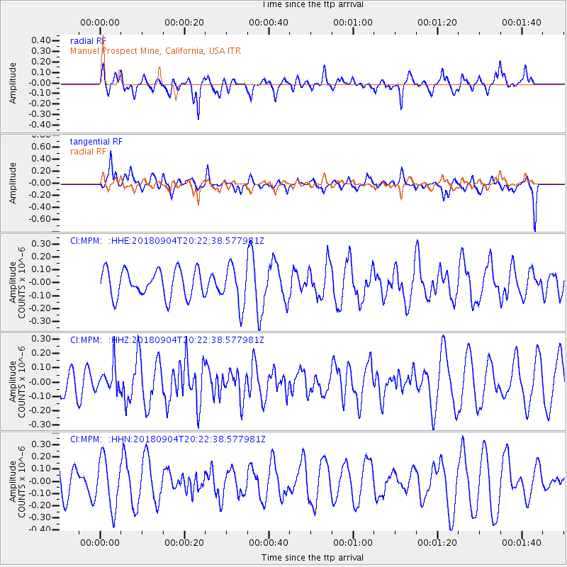
MPM Manuel Prospect Mine, California, USA - Earthquake Result Viewer
*The percent match for this event was below the threshold and hence no stack was calculated.
| Earthquake location: |
Near East Coast Of Honshu, Japan |
| Earthquake latitude/longitude: |
36.4/141.5 |
| Earthquake time(UTC): |
2018/09/04 (247) 20:11:19 GMT |
| Earthquake Depth: |
39 km |
| Earthquake Magnitude: |
5.4 Mww |
| Earthquake Catalog/Contributor: |
NEIC PDE/us |
|
| Network: |
CI Caltech Regional Seismic Network |
| Station: |
MPM Manuel Prospect Mine, California, USA |
| Lat/Lon: |
36.06 N/117.49 W |
| Elevation: |
185 m |
|
| Distance: |
77.2 deg |
| Az: |
54.675 deg |
| Baz: |
305.72 deg |
| Ray Param: |
$rayparam |
*The percent match for this event was below the threshold and hence was not used in the summary stack. |
|
| Radial Match: |
58.55962 % |
| Radial Bump: |
400 |
| Transverse Match: |
67.96927 % |
| Transverse Bump: |
400 |
| SOD ConfigId: |
13570011 |
| Insert Time: |
2019-05-01 02:14:28.876 +0000 |
| GWidth: |
2.5 |
| Max Bumps: |
400 |
| Tol: |
0.001 |
|
Signal To Noise
| Channel | StoN | STA | LTA |
| CI:MPM: :HHZ:20180904T20:22:38.577981Z | 0.57680863 | 8.8568065E-8 | 1.5354844E-7 |
| CI:MPM: :HHN:20180904T20:22:38.577981Z | 1.6077656 | 2.049031E-7 | 1.2744589E-7 |
| CI:MPM: :HHE:20180904T20:22:38.577981Z | 1.530156 | 1.5861953E-7 | 1.0366233E-7 |
| Arrivals |
| Ps | |
| PpPs | |
| PsPs/PpSs | |


