You are here: Home > Network List > CN - Canadian National Seismograph Network Stations List
> Station INK INUVIK, NT > Earthquake Result Viewer
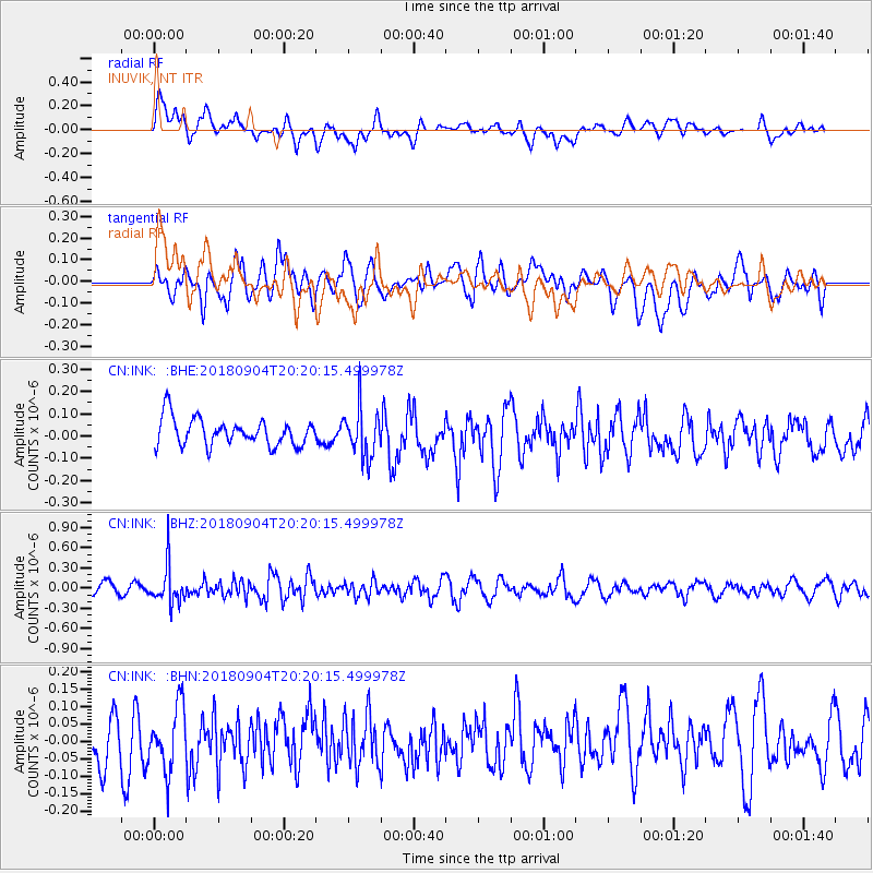
INK INUVIK, NT - Earthquake Result Viewer
*The percent match for this event was below the threshold and hence no stack was calculated.
| Earthquake location: |
Near East Coast Of Honshu, Japan |
| Earthquake latitude/longitude: |
36.4/141.5 |
| Earthquake time(UTC): |
2018/09/04 (247) 20:11:19 GMT |
| Earthquake Depth: |
39 km |
| Earthquake Magnitude: |
5.4 Mww |
| Earthquake Catalog/Contributor: |
NEIC PDE/us |
|
| Network: |
CN Canadian National Seismograph Network |
| Station: |
INK INUVIK, NT |
| Lat/Lon: |
68.31 N/133.53 W |
| Elevation: |
44 m |
|
| Distance: |
54.9 deg |
| Az: |
26.927 deg |
| Baz: |
280.844 deg |
| Ray Param: |
$rayparam |
*The percent match for this event was below the threshold and hence was not used in the summary stack. |
|
| Radial Match: |
63.336258 % |
| Radial Bump: |
400 |
| Transverse Match: |
62.235367 % |
| Transverse Bump: |
400 |
| SOD ConfigId: |
13570011 |
| Insert Time: |
2019-05-01 02:14:57.200 +0000 |
| GWidth: |
2.5 |
| Max Bumps: |
400 |
| Tol: |
0.001 |
|
Signal To Noise
| Channel | StoN | STA | LTA |
| CN:INK: :BHZ:20180904T20:20:15.499978Z | 3.8140101 | 2.8793173E-7 | 7.549317E-8 |
| CN:INK: :BHN:20180904T20:20:15.499978Z | 1.3688074 | 9.1290104E-8 | 6.669317E-8 |
| CN:INK: :BHE:20180904T20:20:15.499978Z | 1.7662615 | 1.0803624E-7 | 6.116662E-8 |
| Arrivals |
| Ps | |
| PpPs | |
| PsPs/PpSs | |


