You are here: Home > Network List > TA - USArray Transportable Network (new EarthScope stations) Stations List
> Station D23K Nanushuk River, AK USA > Earthquake Result Viewer
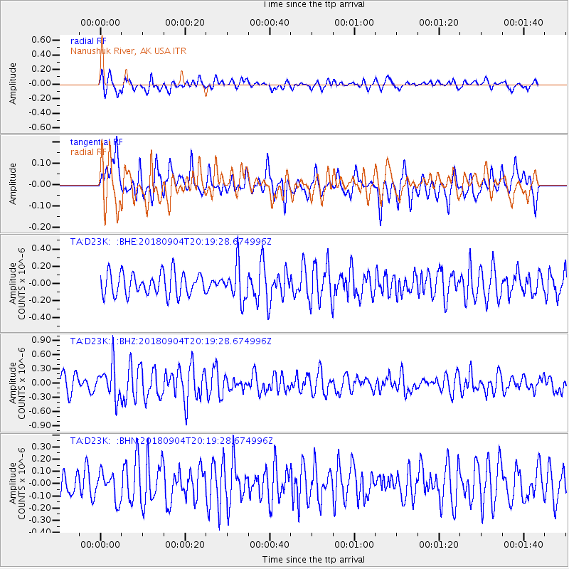
D23K Nanushuk River, AK USA - Earthquake Result Viewer
*The percent match for this event was below the threshold and hence no stack was calculated.
| Earthquake location: |
Near East Coast Of Honshu, Japan |
| Earthquake latitude/longitude: |
36.4/141.5 |
| Earthquake time(UTC): |
2018/09/04 (247) 20:11:19 GMT |
| Earthquake Depth: |
39 km |
| Earthquake Magnitude: |
5.4 Mww |
| Earthquake Catalog/Contributor: |
NEIC PDE/us |
|
| Network: |
TA USArray Transportable Network (new EarthScope stations) |
| Station: |
D23K Nanushuk River, AK USA |
| Lat/Lon: |
68.97 N/150.68 W |
| Elevation: |
406 m |
|
| Distance: |
48.6 deg |
| Az: |
26.472 deg |
| Baz: |
264.583 deg |
| Ray Param: |
$rayparam |
*The percent match for this event was below the threshold and hence was not used in the summary stack. |
|
| Radial Match: |
70.08833 % |
| Radial Bump: |
400 |
| Transverse Match: |
55.56582 % |
| Transverse Bump: |
400 |
| SOD ConfigId: |
13570011 |
| Insert Time: |
2019-05-01 02:19:33.565 +0000 |
| GWidth: |
2.5 |
| Max Bumps: |
400 |
| Tol: |
0.001 |
|
Signal To Noise
| Channel | StoN | STA | LTA |
| TA:D23K: :BHZ:20180904T20:19:28.674996Z | 2.2253575 | 3.547401E-7 | 1.5940815E-7 |
| TA:D23K: :BHN:20180904T20:19:28.674996Z | 0.91681457 | 1.1328374E-7 | 1.2356233E-7 |
| TA:D23K: :BHE:20180904T20:19:28.674996Z | 1.6092185 | 2.0749304E-7 | 1.2894026E-7 |
| Arrivals |
| Ps | |
| PpPs | |
| PsPs/PpSs | |


