You are here: Home > Network List > TA - USArray Transportable Network (new EarthScope stations) Stations List
> Station E20K Nigu River, AK, USA > Earthquake Result Viewer
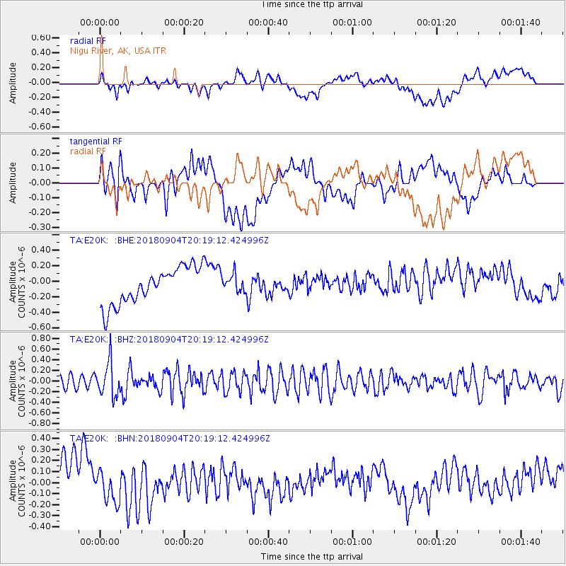
E20K Nigu River, AK, USA - Earthquake Result Viewer
*The percent match for this event was below the threshold and hence no stack was calculated.
| Earthquake location: |
Near East Coast Of Honshu, Japan |
| Earthquake latitude/longitude: |
36.4/141.5 |
| Earthquake time(UTC): |
2018/09/04 (247) 20:11:19 GMT |
| Earthquake Depth: |
39 km |
| Earthquake Magnitude: |
5.4 Mww |
| Earthquake Catalog/Contributor: |
NEIC PDE/us |
|
| Network: |
TA USArray Transportable Network (new EarthScope stations) |
| Station: |
E20K Nigu River, AK, USA |
| Lat/Lon: |
68.26 N/156.19 W |
| Elevation: |
866 m |
|
| Distance: |
46.5 deg |
| Az: |
27.056 deg |
| Baz: |
259.852 deg |
| Ray Param: |
$rayparam |
*The percent match for this event was below the threshold and hence was not used in the summary stack. |
|
| Radial Match: |
28.033974 % |
| Radial Bump: |
400 |
| Transverse Match: |
41.50974 % |
| Transverse Bump: |
400 |
| SOD ConfigId: |
13570011 |
| Insert Time: |
2019-05-01 02:19:40.003 +0000 |
| GWidth: |
2.5 |
| Max Bumps: |
400 |
| Tol: |
0.001 |
|
Signal To Noise
| Channel | StoN | STA | LTA |
| TA:E20K: :BHZ:20180904T20:19:12.424996Z | 3.298858 | 3.221263E-7 | 9.764783E-8 |
| TA:E20K: :BHN:20180904T20:19:12.424996Z | 0.66687196 | 1.272706E-7 | 1.9084713E-7 |
| TA:E20K: :BHE:20180904T20:19:12.424996Z | 0.53820527 | 1.233688E-7 | 2.292226E-7 |
| Arrivals |
| Ps | |
| PpPs | |
| PsPs/PpSs | |


