You are here: Home > Network List > TA - USArray Transportable Network (new EarthScope stations) Stations List
> Station F20K Avaraart Lake, AK, USA > Earthquake Result Viewer
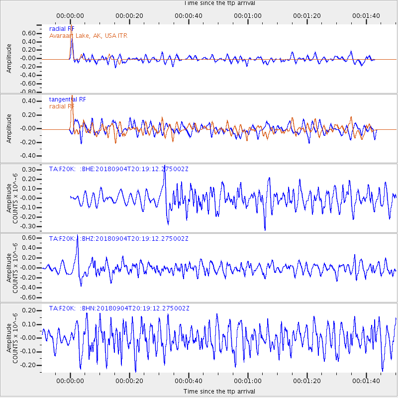
F20K Avaraart Lake, AK, USA - Earthquake Result Viewer
*The percent match for this event was below the threshold and hence no stack was calculated.
| Earthquake location: |
Near East Coast Of Honshu, Japan |
| Earthquake latitude/longitude: |
36.4/141.5 |
| Earthquake time(UTC): |
2018/09/04 (247) 20:11:19 GMT |
| Earthquake Depth: |
39 km |
| Earthquake Magnitude: |
5.4 Mww |
| Earthquake Catalog/Contributor: |
NEIC PDE/us |
|
| Network: |
TA USArray Transportable Network (new EarthScope stations) |
| Station: |
F20K Avaraart Lake, AK, USA |
| Lat/Lon: |
67.05 N/155.73 W |
| Elevation: |
136 m |
|
| Distance: |
46.5 deg |
| Az: |
28.749 deg |
| Baz: |
261.447 deg |
| Ray Param: |
$rayparam |
*The percent match for this event was below the threshold and hence was not used in the summary stack. |
|
| Radial Match: |
70.511795 % |
| Radial Bump: |
400 |
| Transverse Match: |
61.55338 % |
| Transverse Bump: |
400 |
| SOD ConfigId: |
13570011 |
| Insert Time: |
2019-05-01 02:19:50.365 +0000 |
| GWidth: |
2.5 |
| Max Bumps: |
400 |
| Tol: |
0.001 |
|
Signal To Noise
| Channel | StoN | STA | LTA |
| TA:F20K: :BHZ:20180904T20:19:12.275002Z | 3.5876417 | 2.398094E-7 | 6.6843185E-8 |
| TA:F20K: :BHN:20180904T20:19:12.275002Z | 1.580287 | 9.340296E-8 | 5.9105062E-8 |
| TA:F20K: :BHE:20180904T20:19:12.275002Z | 2.8733852 | 1.4949953E-7 | 5.202906E-8 |
| Arrivals |
| Ps | |
| PpPs | |
| PsPs/PpSs | |


