You are here: Home > Network List > TA - USArray Transportable Network (new EarthScope stations) Stations List
> Station K13K Kusilvak Mountain, AK, USA > Earthquake Result Viewer
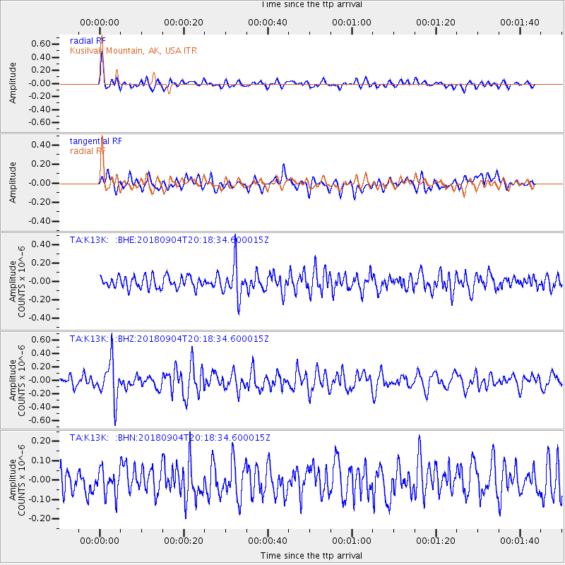
K13K Kusilvak Mountain, AK, USA - Earthquake Result Viewer
*The percent match for this event was below the threshold and hence no stack was calculated.
| Earthquake location: |
Near East Coast Of Honshu, Japan |
| Earthquake latitude/longitude: |
36.4/141.5 |
| Earthquake time(UTC): |
2018/09/04 (247) 20:11:19 GMT |
| Earthquake Depth: |
39 km |
| Earthquake Magnitude: |
5.4 Mww |
| Earthquake Catalog/Contributor: |
NEIC PDE/us |
|
| Network: |
TA USArray Transportable Network (new EarthScope stations) |
| Station: |
K13K Kusilvak Mountain, AK, USA |
| Lat/Lon: |
61.93 N/164.66 W |
| Elevation: |
204 m |
|
| Distance: |
41.7 deg |
| Az: |
34.994 deg |
| Baz: |
257.878 deg |
| Ray Param: |
$rayparam |
*The percent match for this event was below the threshold and hence was not used in the summary stack. |
|
| Radial Match: |
65.29512 % |
| Radial Bump: |
400 |
| Transverse Match: |
62.72209 % |
| Transverse Bump: |
400 |
| SOD ConfigId: |
13570011 |
| Insert Time: |
2019-05-01 02:20:30.994 +0000 |
| GWidth: |
2.5 |
| Max Bumps: |
400 |
| Tol: |
0.001 |
|
Signal To Noise
| Channel | StoN | STA | LTA |
| TA:K13K: :BHZ:20180904T20:18:34.600015Z | 3.3320415 | 2.904998E-7 | 8.718372E-8 |
| TA:K13K: :BHN:20180904T20:18:34.600015Z | 1.0105811 | 6.4196534E-8 | 6.352437E-8 |
| TA:K13K: :BHE:20180904T20:18:34.600015Z | 2.8999279 | 1.8375091E-7 | 6.336396E-8 |
| Arrivals |
| Ps | |
| PpPs | |
| PsPs/PpSs | |


