You are here: Home > Network List > TA - USArray Transportable Network (new EarthScope stations) Stations List
> Station J17A Brown Place, Jackson, WY, USA > Earthquake Result Viewer
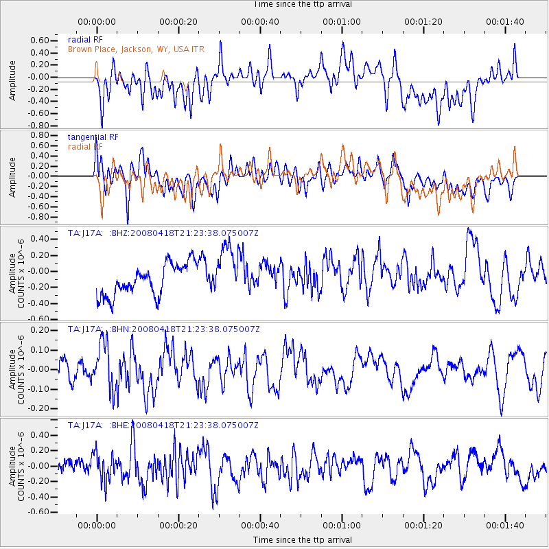
J17A Brown Place, Jackson, WY, USA - Earthquake Result Viewer
*The percent match for this event was below the threshold and hence no stack was calculated.
| Earthquake location: |
Kermadec Islands Region |
| Earthquake latitude/longitude: |
-27.5/-176.6 |
| Earthquake time(UTC): |
2008/04/18 (109) 21:10:56 GMT |
| Earthquake Depth: |
10 km |
| Earthquake Magnitude: |
5.6 MS, 5.4 MB, 5.8 MW, 5.8 MW |
| Earthquake Catalog/Contributor: |
WHDF/NEIC |
|
| Network: |
TA USArray Transportable Network (new EarthScope stations) |
| Station: |
J17A Brown Place, Jackson, WY, USA |
| Lat/Lon: |
43.36 N/110.71 W |
| Elevation: |
1975 m |
|
| Distance: |
92.9 deg |
| Az: |
41.79 deg |
| Baz: |
234.238 deg |
| Ray Param: |
$rayparam |
*The percent match for this event was below the threshold and hence was not used in the summary stack. |
|
| Radial Match: |
52.279797 % |
| Radial Bump: |
400 |
| Transverse Match: |
57.535694 % |
| Transverse Bump: |
400 |
| SOD ConfigId: |
2504 |
| Insert Time: |
2010-03-06 15:10:06.666 +0000 |
| GWidth: |
2.5 |
| Max Bumps: |
400 |
| Tol: |
0.001 |
|
Signal To Noise
| Channel | StoN | STA | LTA |
| TA:J17A: :BHN:20080418T21:23:38.075007Z | 2.1205783 | 1.2414688E-7 | 5.854388E-8 |
| TA:J17A: :BHE:20080418T21:23:38.075007Z | 2.0023077 | 1.8355995E-7 | 9.16742E-8 |
| TA:J17A: :BHZ:20080418T21:23:38.075007Z | 1.7253556 | 3.3639523E-7 | 1.9497155E-7 |
| Arrivals |
| Ps | |
| PpPs | |
| PsPs/PpSs | |


