You are here: Home > Network List > TA - USArray Transportable Network (new EarthScope stations) Stations List
> Station J17A Brown Place, Jackson, WY, USA > Earthquake Result Viewer
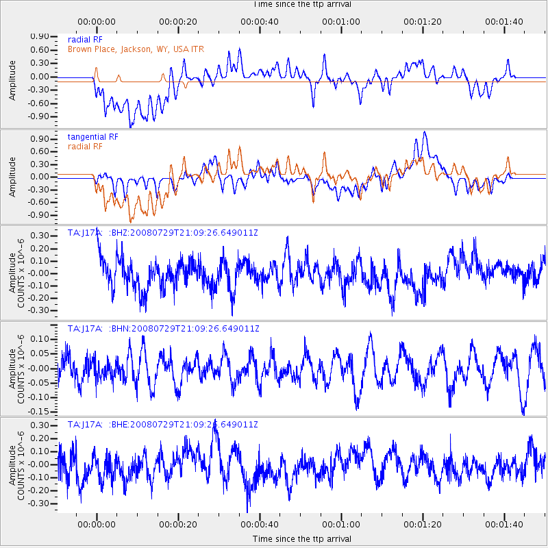
J17A Brown Place, Jackson, WY, USA - Earthquake Result Viewer
*The percent match for this event was below the threshold and hence no stack was calculated.
| Earthquake location: |
Southern East Pacific Rise |
| Earthquake latitude/longitude: |
-54.7/-118.8 |
| Earthquake time(UTC): |
2008/07/29 (211) 20:56:22 GMT |
| Earthquake Depth: |
10 km |
| Earthquake Magnitude: |
5.5 MB, 5.4 MS, 5.8 MW, 5.7 MW |
| Earthquake Catalog/Contributor: |
WHDF/NEIC |
|
| Network: |
TA USArray Transportable Network (new EarthScope stations) |
| Station: |
J17A Brown Place, Jackson, WY, USA |
| Lat/Lon: |
43.36 N/110.71 W |
| Elevation: |
1975 m |
|
| Distance: |
98.0 deg |
| Az: |
5.935 deg |
| Baz: |
184.717 deg |
| Ray Param: |
$rayparam |
*The percent match for this event was below the threshold and hence was not used in the summary stack. |
|
| Radial Match: |
45.61926 % |
| Radial Bump: |
400 |
| Transverse Match: |
48.53483 % |
| Transverse Bump: |
400 |
| SOD ConfigId: |
2504 |
| Insert Time: |
2010-03-06 15:10:28.206 +0000 |
| GWidth: |
2.5 |
| Max Bumps: |
400 |
| Tol: |
0.001 |
|
Signal To Noise
| Channel | StoN | STA | LTA |
| TA:J17A: :BHN:20080729T21:09:26.649011Z | 0.7047917 | 2.9741406E-8 | 4.2198856E-8 |
| TA:J17A: :BHE:20080729T21:09:26.649011Z | 1.0755289 | 1.3022357E-7 | 1.2107864E-7 |
| TA:J17A: :BHZ:20080729T21:09:26.649011Z | 1.0954103 | 1.2710561E-7 | 1.160347E-7 |
| Arrivals |
| Ps | |
| PpPs | |
| PsPs/PpSs | |


