You are here: Home > Network List > TA - USArray Transportable Network (new EarthScope stations) Stations List
> Station J17A Brown Place, Jackson, WY, USA > Earthquake Result Viewer
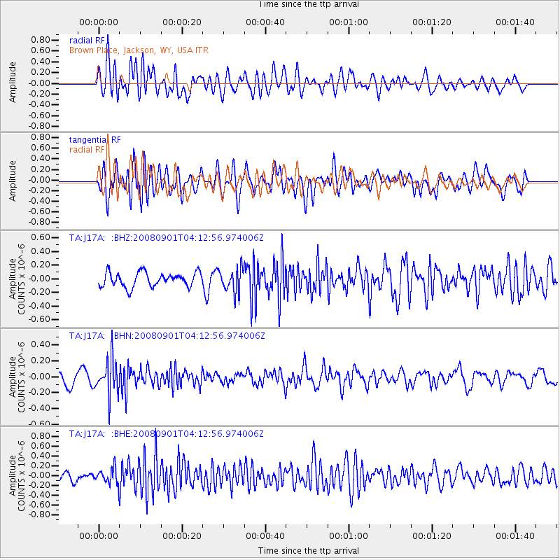
J17A Brown Place, Jackson, WY, USA - Earthquake Result Viewer
*The percent match for this event was below the threshold and hence no stack was calculated.
| Earthquake location: |
South Of Fiji Islands |
| Earthquake latitude/longitude: |
-25.4/-177.6 |
| Earthquake time(UTC): |
2008/09/01 (245) 04:00:39 GMT |
| Earthquake Depth: |
171 km |
| Earthquake Magnitude: |
5.7 MB, 6.0 MW, 6.0 MW |
| Earthquake Catalog/Contributor: |
WHDF/NEIC |
|
| Network: |
TA USArray Transportable Network (new EarthScope stations) |
| Station: |
J17A Brown Place, Jackson, WY, USA |
| Lat/Lon: |
43.36 N/110.71 W |
| Elevation: |
1975 m |
|
| Distance: |
91.9 deg |
| Az: |
42.17 deg |
| Baz: |
236.369 deg |
| Ray Param: |
$rayparam |
*The percent match for this event was below the threshold and hence was not used in the summary stack. |
|
| Radial Match: |
64.27992 % |
| Radial Bump: |
400 |
| Transverse Match: |
56.039707 % |
| Transverse Bump: |
400 |
| SOD ConfigId: |
2504 |
| Insert Time: |
2010-03-06 15:10:47.767 +0000 |
| GWidth: |
2.5 |
| Max Bumps: |
400 |
| Tol: |
0.001 |
|
Signal To Noise
| Channel | StoN | STA | LTA |
| TA:J17A: :BHN:20080901T04:12:56.974006Z | 3.2765684 | 2.1778229E-7 | 6.6466576E-8 |
| TA:J17A: :BHE:20080901T04:12:56.974006Z | 1.2508367 | 1.5325878E-7 | 1.2252501E-7 |
| TA:J17A: :BHZ:20080901T04:12:56.974006Z | 1.6538005 | 1.750321E-7 | 1.0583629E-7 |
| Arrivals |
| Ps | |
| PpPs | |
| PsPs/PpSs | |


