You are here: Home > Network List > TA - USArray Transportable Network (new EarthScope stations) Stations List
> Station P17K Kvichak River, AK, USA > Earthquake Result Viewer
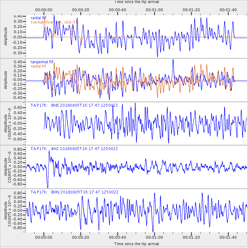
P17K Kvichak River, AK, USA - Earthquake Result Viewer
*The percent match for this event was below the threshold and hence no stack was calculated.
| Earthquake location: |
South Of Tonga Islands |
| Earthquake latitude/longitude: |
-24.0/-174.8 |
| Earthquake time(UTC): |
2018/09/05 (248) 16:05:46 GMT |
| Earthquake Depth: |
10 km |
| Earthquake Magnitude: |
5.5 mb |
| Earthquake Catalog/Contributor: |
NEIC PDE/us |
|
| Network: |
TA USArray Transportable Network (new EarthScope stations) |
| Station: |
P17K Kvichak River, AK, USA |
| Lat/Lon: |
59.20 N/156.44 W |
| Elevation: |
91 m |
|
| Distance: |
84.3 deg |
| Az: |
9.377 deg |
| Baz: |
196.83 deg |
| Ray Param: |
$rayparam |
*The percent match for this event was below the threshold and hence was not used in the summary stack. |
|
| Radial Match: |
50.760395 % |
| Radial Bump: |
400 |
| Transverse Match: |
47.643993 % |
| Transverse Bump: |
400 |
| SOD ConfigId: |
13570011 |
| Insert Time: |
2019-05-01 02:41:51.982 +0000 |
| GWidth: |
2.5 |
| Max Bumps: |
400 |
| Tol: |
0.001 |
|
Signal To Noise
| Channel | StoN | STA | LTA |
| TA:P17K: :BHZ:20180905T16:17:47.125002Z | 4.3907347 | 4.1886884E-7 | 9.539835E-8 |
| TA:P17K: :BHN:20180905T16:17:47.125002Z | 1.0336983 | 2.195986E-7 | 2.1243974E-7 |
| TA:P17K: :BHE:20180905T16:17:47.125002Z | 0.93403196 | 2.3005894E-7 | 2.4630737E-7 |
| Arrivals |
| Ps | |
| PpPs | |
| PsPs/PpSs | |


