You are here: Home > Network List > TA - USArray Transportable Network (new EarthScope stations) Stations List
> Station R32K Eaglecrest, AK, USA > Earthquake Result Viewer
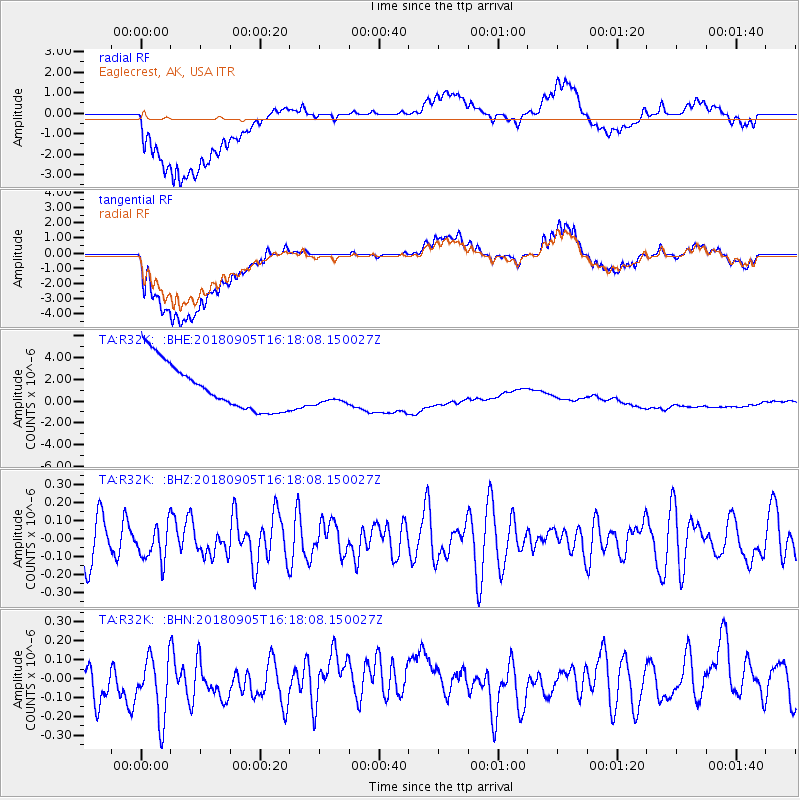
R32K Eaglecrest, AK, USA - Earthquake Result Viewer
*The percent match for this event was below the threshold and hence no stack was calculated.
| Earthquake location: |
South Of Tonga Islands |
| Earthquake latitude/longitude: |
-24.0/-174.8 |
| Earthquake time(UTC): |
2018/09/05 (248) 16:05:46 GMT |
| Earthquake Depth: |
10 km |
| Earthquake Magnitude: |
5.5 mb |
| Earthquake Catalog/Contributor: |
NEIC PDE/us |
|
| Network: |
TA USArray Transportable Network (new EarthScope stations) |
| Station: |
R32K Eaglecrest, AK, USA |
| Lat/Lon: |
58.27 N/134.52 W |
| Elevation: |
386 m |
|
| Distance: |
88.6 deg |
| Az: |
19.984 deg |
| Baz: |
216.263 deg |
| Ray Param: |
$rayparam |
*The percent match for this event was below the threshold and hence was not used in the summary stack. |
|
| Radial Match: |
25.405434 % |
| Radial Bump: |
400 |
| Transverse Match: |
25.574463 % |
| Transverse Bump: |
400 |
| SOD ConfigId: |
13570011 |
| Insert Time: |
2019-05-01 02:41:58.513 +0000 |
| GWidth: |
2.5 |
| Max Bumps: |
400 |
| Tol: |
0.001 |
|
Signal To Noise
| Channel | StoN | STA | LTA |
| TA:R32K: :BHZ:20180905T16:18:08.150027Z | 0.7775446 | 1.0200319E-7 | 1.311863E-7 |
| TA:R32K: :BHN:20180905T16:18:08.150027Z | 1.5694643 | 1.8306953E-7 | 1.1664459E-7 |
| TA:R32K: :BHE:20180905T16:18:08.150027Z | 0.57917815 | 1.2707727E-6 | 2.1940964E-6 |
| Arrivals |
| Ps | |
| PpPs | |
| PsPs/PpSs | |


