You are here: Home > Network List > UW - Pacific Northwest Regional Seismic Network Stations List
> Station UMAT Pilot Rock, OR, USA > Earthquake Result Viewer
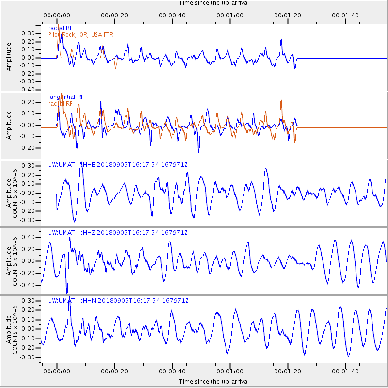
UMAT Pilot Rock, OR, USA - Earthquake Result Viewer
*The percent match for this event was below the threshold and hence no stack was calculated.
| Earthquake location: |
South Of Tonga Islands |
| Earthquake latitude/longitude: |
-24.0/-174.8 |
| Earthquake time(UTC): |
2018/09/05 (248) 16:05:46 GMT |
| Earthquake Depth: |
10 km |
| Earthquake Magnitude: |
5.5 mb |
| Earthquake Catalog/Contributor: |
NEIC PDE/us |
|
| Network: |
UW Pacific Northwest Regional Seismic Network |
| Station: |
UMAT Pilot Rock, OR, USA |
| Lat/Lon: |
45.29 N/118.96 W |
| Elevation: |
1318 m |
|
| Distance: |
85.6 deg |
| Az: |
35.86 deg |
| Baz: |
229.372 deg |
| Ray Param: |
$rayparam |
*The percent match for this event was below the threshold and hence was not used in the summary stack. |
|
| Radial Match: |
63.519413 % |
| Radial Bump: |
400 |
| Transverse Match: |
49.174267 % |
| Transverse Bump: |
294 |
| SOD ConfigId: |
13570011 |
| Insert Time: |
2019-05-01 02:43:06.936 +0000 |
| GWidth: |
2.5 |
| Max Bumps: |
400 |
| Tol: |
0.001 |
|
Signal To Noise
| Channel | StoN | STA | LTA |
| UW:UMAT: :HHZ:20180905T16:17:54.167971Z | 1.9086711 | 2.4826724E-7 | 1.3007335E-7 |
| UW:UMAT: :HHN:20180905T16:17:54.167971Z | 1.6509942 | 1.3138336E-7 | 7.957833E-8 |
| UW:UMAT: :HHE:20180905T16:17:54.167971Z | 0.7224702 | 9.4937235E-8 | 1.3140644E-7 |
| Arrivals |
| Ps | |
| PpPs | |
| PsPs/PpSs | |


