You are here: Home > Network List > AV - Alaska Volcano Observatory Stations List
> Station SPCR Ckakachatna River, Mount Spurr, Alaska > Earthquake Result Viewer
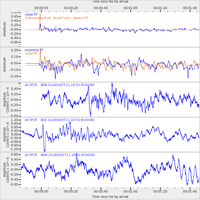
SPCR Ckakachatna River, Mount Spurr, Alaska - Earthquake Result Viewer
*The percent match for this event was below the threshold and hence no stack was calculated.
| Earthquake location: |
Hokkaido, Japan Region |
| Earthquake latitude/longitude: |
42.7/142.0 |
| Earthquake time(UTC): |
2018/09/05 (248) 21:11:29 GMT |
| Earthquake Depth: |
36 km |
| Earthquake Magnitude: |
5.4 Mww |
| Earthquake Catalog/Contributor: |
NEIC PDE/us |
|
| Network: |
AV Alaska Volcano Observatory |
| Station: |
SPCR Ckakachatna River, Mount Spurr, Alaska |
| Lat/Lon: |
61.20 N/152.21 W |
| Elevation: |
984 m |
|
| Distance: |
42.5 deg |
| Az: |
40.823 deg |
| Baz: |
275.336 deg |
| Ray Param: |
$rayparam |
*The percent match for this event was below the threshold and hence was not used in the summary stack. |
|
| Radial Match: |
58.8721 % |
| Radial Bump: |
400 |
| Transverse Match: |
58.51371 % |
| Transverse Bump: |
400 |
| SOD ConfigId: |
13570011 |
| Insert Time: |
2019-05-01 02:56:09.177 +0000 |
| GWidth: |
2.5 |
| Max Bumps: |
400 |
| Tol: |
0.001 |
|
Signal To Noise
| Channel | StoN | STA | LTA |
| AV:SPCR: :BHZ:20180905T21:18:50.839008Z | 5.062756 | 6.371171E-7 | 1.2584394E-7 |
| AV:SPCR: :BHN:20180905T21:18:50.839008Z | 0.6297076 | 1.5934317E-7 | 2.530431E-7 |
| AV:SPCR: :BHE:20180905T21:18:50.839008Z | 1.7759069 | 2.6473913E-7 | 1.4907263E-7 |
| Arrivals |
| Ps | |
| PpPs | |
| PsPs/PpSs | |


