You are here: Home > Network List > CN - Canadian National Seismograph Network Stations List
> Station INK INUVIK, NT > Earthquake Result Viewer
INK INUVIK, NT - Earthquake Result Viewer
*The percent match for this event was below the threshold and hence no stack was calculated.
| Earthquake location: |
Hokkaido, Japan Region |
| Earthquake latitude/longitude: |
42.7/142.0 |
| Earthquake time(UTC): |
2018/09/05 (248) 21:11:29 GMT |
| Earthquake Depth: |
36 km |
| Earthquake Magnitude: |
5.4 Mww |
| Earthquake Catalog/Contributor: |
NEIC PDE/us |
|
| Network: |
CN Canadian National Seismograph Network |
| Station: |
INK INUVIK, NT |
| Lat/Lon: |
68.31 N/133.53 W |
| Elevation: |
44 m |
|
| Distance: |
49.2 deg |
| Az: |
29.256 deg |
| Baz: |
284.193 deg |
| Ray Param: |
$rayparam |
*The percent match for this event was below the threshold and hence was not used in the summary stack. |
|
| Radial Match: |
56.089684 % |
| Radial Bump: |
400 |
| Transverse Match: |
60.494747 % |
| Transverse Bump: |
400 |
| SOD ConfigId: |
13570011 |
| Insert Time: |
2019-05-01 02:57:25.879 +0000 |
| GWidth: |
2.5 |
| Max Bumps: |
400 |
| Tol: |
0.001 |
|
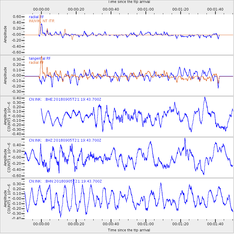
Signal To Noise
| Channel | StoN | STA | LTA |
| CN:INK: :BHZ:20180905T21:19:43.700Z | 1.4588947 | 2.740543E-7 | 1.8785063E-7 |
| CN:INK: :BHN:20180905T21:19:43.700Z | 1.2508589 | 1.6201608E-7 | 1.2952387E-7 |
| CN:INK: :BHE:20180905T21:19:43.700Z | 1.8641685 | 1.7922706E-7 | 9.614317E-8 |
| Arrivals |
| Ps | |
| PpPs | |
| PsPs/PpSs | |


