You are here: Home > Network List > TA - USArray Transportable Network (new EarthScope stations) Stations List
> Station O17K Koliganek, Bristol Bay, AK, USA > Earthquake Result Viewer
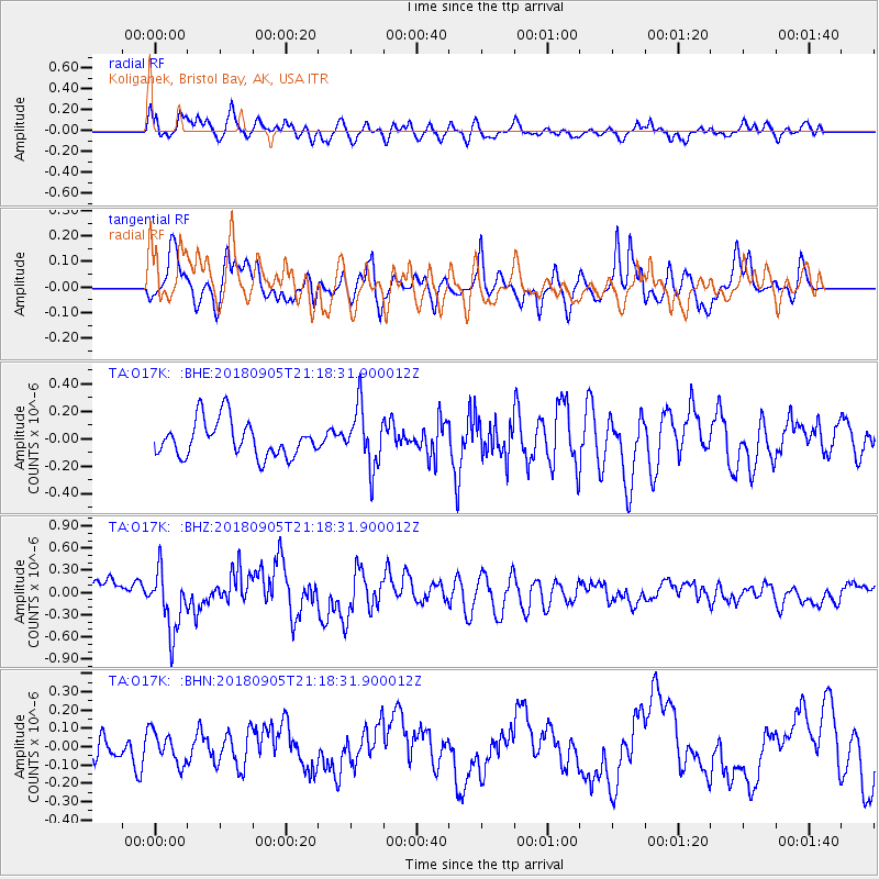
O17K Koliganek, Bristol Bay, AK, USA - Earthquake Result Viewer
*The percent match for this event was below the threshold and hence no stack was calculated.
| Earthquake location: |
Hokkaido, Japan Region |
| Earthquake latitude/longitude: |
42.7/142.0 |
| Earthquake time(UTC): |
2018/09/05 (248) 21:11:29 GMT |
| Earthquake Depth: |
36 km |
| Earthquake Magnitude: |
5.4 Mww |
| Earthquake Catalog/Contributor: |
NEIC PDE/us |
|
| Network: |
TA USArray Transportable Network (new EarthScope stations) |
| Station: |
O17K Koliganek, Bristol Bay, AK, USA |
| Lat/Lon: |
59.77 N/157.09 W |
| Elevation: |
156 m |
|
| Distance: |
40.2 deg |
| Az: |
43.245 deg |
| Baz: |
272.909 deg |
| Ray Param: |
$rayparam |
*The percent match for this event was below the threshold and hence was not used in the summary stack. |
|
| Radial Match: |
74.1868 % |
| Radial Bump: |
400 |
| Transverse Match: |
79.60164 % |
| Transverse Bump: |
400 |
| SOD ConfigId: |
13570011 |
| Insert Time: |
2019-05-01 03:02:29.075 +0000 |
| GWidth: |
2.5 |
| Max Bumps: |
400 |
| Tol: |
0.001 |
|
Signal To Noise
| Channel | StoN | STA | LTA |
| TA:O17K: :BHZ:20180905T21:18:31.900012Z | 2.460254 | 4.1611207E-7 | 1.6913378E-7 |
| TA:O17K: :BHN:20180905T21:18:31.900012Z | 0.6506482 | 8.618027E-8 | 1.3245295E-7 |
| TA:O17K: :BHE:20180905T21:18:31.900012Z | 1.6775342 | 2.1681697E-7 | 1.2924743E-7 |
| Arrivals |
| Ps | |
| PpPs | |
| PsPs/PpSs | |


