You are here: Home > Network List > AV - Alaska Volcano Observatory Stations List
> Station MAPS Pakushin Southeast, Makushin Volcano, Alaska > Earthquake Result Viewer
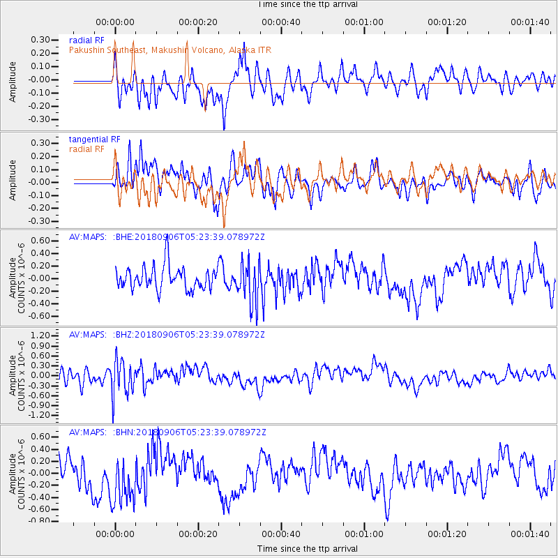
MAPS Pakushin Southeast, Makushin Volcano, Alaska - Earthquake Result Viewer
*The percent match for this event was below the threshold and hence no stack was calculated.
| Earthquake location: |
Fiji Islands Region |
| Earthquake latitude/longitude: |
-18.0/-178.5 |
| Earthquake time(UTC): |
2018/09/06 (249) 05:13:39 GMT |
| Earthquake Depth: |
531 km |
| Earthquake Magnitude: |
5.5 Mww |
| Earthquake Catalog/Contributor: |
NEIC PDE/us |
|
| Network: |
AV Alaska Volcano Observatory |
| Station: |
MAPS Pakushin Southeast, Makushin Volcano, Alaska |
| Lat/Lon: |
53.81 N/166.94 W |
| Elevation: |
333 m |
|
| Distance: |
72.2 deg |
| Az: |
7.188 deg |
| Baz: |
191.585 deg |
| Ray Param: |
$rayparam |
*The percent match for this event was below the threshold and hence was not used in the summary stack. |
|
| Radial Match: |
43.096703 % |
| Radial Bump: |
400 |
| Transverse Match: |
62.721848 % |
| Transverse Bump: |
400 |
| SOD ConfigId: |
13570011 |
| Insert Time: |
2019-05-01 03:06:48.204 +0000 |
| GWidth: |
2.5 |
| Max Bumps: |
400 |
| Tol: |
0.001 |
|
Signal To Noise
| Channel | StoN | STA | LTA |
| AV:MAPS: :BHZ:20180906T05:23:39.078972Z | 2.6418161 | 5.4428426E-7 | 2.0602654E-7 |
| AV:MAPS: :BHN:20180906T05:23:39.078972Z | 2.133175 | 4.663518E-7 | 2.1861864E-7 |
| AV:MAPS: :BHE:20180906T05:23:39.078972Z | 1.8264036 | 3.3942862E-7 | 1.8584535E-7 |
| Arrivals |
| Ps | |
| PpPs | |
| PsPs/PpSs | |


