You are here: Home > Network List > CI - Caltech Regional Seismic Network Stations List
> Station MPM Manuel Prospect Mine, California, USA > Earthquake Result Viewer
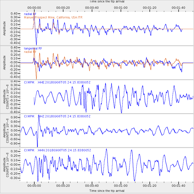
MPM Manuel Prospect Mine, California, USA - Earthquake Result Viewer
*The percent match for this event was below the threshold and hence no stack was calculated.
| Earthquake location: |
Fiji Islands Region |
| Earthquake latitude/longitude: |
-18.0/-178.5 |
| Earthquake time(UTC): |
2018/09/06 (249) 05:13:39 GMT |
| Earthquake Depth: |
531 km |
| Earthquake Magnitude: |
5.5 Mww |
| Earthquake Catalog/Contributor: |
NEIC PDE/us |
|
| Network: |
CI Caltech Regional Seismic Network |
| Station: |
MPM Manuel Prospect Mine, California, USA |
| Lat/Lon: |
36.06 N/117.49 W |
| Elevation: |
185 m |
|
| Distance: |
78.8 deg |
| Az: |
46.274 deg |
| Baz: |
238.087 deg |
| Ray Param: |
$rayparam |
*The percent match for this event was below the threshold and hence was not used in the summary stack. |
|
| Radial Match: |
68.30593 % |
| Radial Bump: |
400 |
| Transverse Match: |
51.45833 % |
| Transverse Bump: |
400 |
| SOD ConfigId: |
13570011 |
| Insert Time: |
2019-05-01 03:08:19.042 +0000 |
| GWidth: |
2.5 |
| Max Bumps: |
400 |
| Tol: |
0.001 |
|
Signal To Noise
| Channel | StoN | STA | LTA |
| CI:MPM: :HHZ:20180906T05:24:15.838005Z | 3.9545312 | 4.983456E-7 | 1.2601889E-7 |
| CI:MPM: :HHN:20180906T05:24:15.838005Z | 1.2078995 | 1.6231411E-7 | 1.3437717E-7 |
| CI:MPM: :HHE:20180906T05:24:15.838005Z | 1.7468562 | 1.847346E-7 | 1.05752605E-7 |
| Arrivals |
| Ps | |
| PpPs | |
| PsPs/PpSs | |


