You are here: Home > Network List > TA - USArray Transportable Network (new EarthScope stations) Stations List
> Station G21K Allakaket, AK, USA > Earthquake Result Viewer
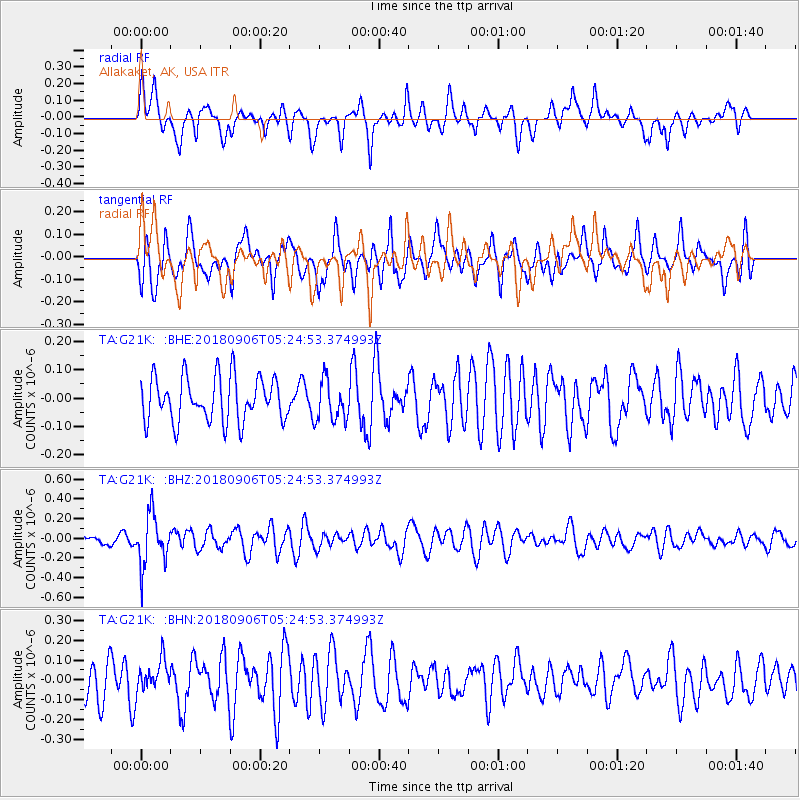
G21K Allakaket, AK, USA - Earthquake Result Viewer
*The percent match for this event was below the threshold and hence no stack was calculated.
| Earthquake location: |
Fiji Islands Region |
| Earthquake latitude/longitude: |
-18.0/-178.5 |
| Earthquake time(UTC): |
2018/09/06 (249) 05:13:39 GMT |
| Earthquake Depth: |
531 km |
| Earthquake Magnitude: |
5.5 Mww |
| Earthquake Catalog/Contributor: |
NEIC PDE/us |
|
| Network: |
TA USArray Transportable Network (new EarthScope stations) |
| Station: |
G21K Allakaket, AK, USA |
| Lat/Lon: |
66.52 N/153.51 W |
| Elevation: |
446 m |
|
| Distance: |
86.3 deg |
| Az: |
9.78 deg |
| Baz: |
203.793 deg |
| Ray Param: |
$rayparam |
*The percent match for this event was below the threshold and hence was not used in the summary stack. |
|
| Radial Match: |
53.0593 % |
| Radial Bump: |
400 |
| Transverse Match: |
50.704224 % |
| Transverse Bump: |
400 |
| SOD ConfigId: |
13570011 |
| Insert Time: |
2019-05-01 03:11:35.846 +0000 |
| GWidth: |
2.5 |
| Max Bumps: |
400 |
| Tol: |
0.001 |
|
Signal To Noise
| Channel | StoN | STA | LTA |
| TA:G21K: :BHZ:20180906T05:24:53.374993Z | 3.375572 | 2.5852574E-7 | 7.658724E-8 |
| TA:G21K: :BHN:20180906T05:24:53.374993Z | 1.0455621 | 7.988861E-8 | 7.640733E-8 |
| TA:G21K: :BHE:20180906T05:24:53.374993Z | 0.92508936 | 7.266676E-8 | 7.855107E-8 |
| Arrivals |
| Ps | |
| PpPs | |
| PsPs/PpSs | |


