You are here: Home > Network List > TA - USArray Transportable Network (new EarthScope stations) Stations List
> Station Q17K Contact Creek, Katmai, AK, USA > Earthquake Result Viewer
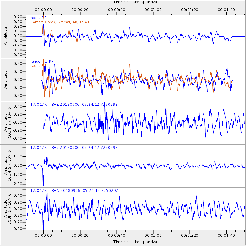
Q17K Contact Creek, Katmai, AK, USA - Earthquake Result Viewer
*The percent match for this event was below the threshold and hence no stack was calculated.
| Earthquake location: |
Fiji Islands Region |
| Earthquake latitude/longitude: |
-18.0/-178.5 |
| Earthquake time(UTC): |
2018/09/06 (249) 05:13:39 GMT |
| Earthquake Depth: |
531 km |
| Earthquake Magnitude: |
5.5 Mww |
| Earthquake Catalog/Contributor: |
NEIC PDE/us |
|
| Network: |
TA USArray Transportable Network (new EarthScope stations) |
| Station: |
Q17K Contact Creek, Katmai, AK, USA |
| Lat/Lon: |
58.26 N/155.89 W |
| Elevation: |
1165 m |
|
| Distance: |
78.2 deg |
| Az: |
11.997 deg |
| Baz: |
201.98 deg |
| Ray Param: |
$rayparam |
*The percent match for this event was below the threshold and hence was not used in the summary stack. |
|
| Radial Match: |
51.65968 % |
| Radial Bump: |
400 |
| Transverse Match: |
55.919266 % |
| Transverse Bump: |
400 |
| SOD ConfigId: |
13570011 |
| Insert Time: |
2019-05-01 03:12:51.945 +0000 |
| GWidth: |
2.5 |
| Max Bumps: |
400 |
| Tol: |
0.001 |
|
Signal To Noise
| Channel | StoN | STA | LTA |
| TA:Q17K: :BHZ:20180906T05:24:12.725029Z | 5.0729723 | 5.9223134E-7 | 1.16742484E-7 |
| TA:Q17K: :BHN:20180906T05:24:12.725029Z | 1.7536091 | 2.4395425E-7 | 1.3911553E-7 |
| TA:Q17K: :BHE:20180906T05:24:12.725029Z | 1.733857 | 2.04582E-7 | 1.1799242E-7 |
| Arrivals |
| Ps | |
| PpPs | |
| PsPs/PpSs | |


