You are here: Home > Network List > TA - USArray Transportable Network (new EarthScope stations) Stations List
> Station R33M Jennings River, BC, CAN > Earthquake Result Viewer
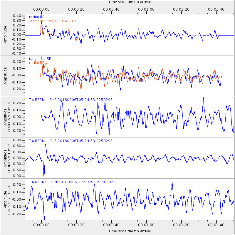
R33M Jennings River, BC, CAN - Earthquake Result Viewer
*The percent match for this event was below the threshold and hence no stack was calculated.
| Earthquake location: |
Fiji Islands Region |
| Earthquake latitude/longitude: |
-18.0/-178.5 |
| Earthquake time(UTC): |
2018/09/06 (249) 05:13:39 GMT |
| Earthquake Depth: |
531 km |
| Earthquake Magnitude: |
5.5 Mww |
| Earthquake Catalog/Contributor: |
NEIC PDE/us |
|
| Network: |
TA USArray Transportable Network (new EarthScope stations) |
| Station: |
R33M Jennings River, BC, CAN |
| Lat/Lon: |
59.39 N/130.97 W |
| Elevation: |
1437 m |
|
| Distance: |
86.3 deg |
| Az: |
22.235 deg |
| Baz: |
224.742 deg |
| Ray Param: |
$rayparam |
*The percent match for this event was below the threshold and hence was not used in the summary stack. |
|
| Radial Match: |
51.166706 % |
| Radial Bump: |
400 |
| Transverse Match: |
52.488686 % |
| Transverse Bump: |
400 |
| SOD ConfigId: |
13570011 |
| Insert Time: |
2019-05-01 03:12:59.356 +0000 |
| GWidth: |
2.5 |
| Max Bumps: |
400 |
| Tol: |
0.001 |
|
Signal To Noise
| Channel | StoN | STA | LTA |
| TA:R33M: :BHZ:20180906T05:24:53.225029Z | 5.478775 | 3.7033402E-7 | 6.7594314E-8 |
| TA:R33M: :BHN:20180906T05:24:53.225029Z | 1.4762522 | 9.332958E-8 | 6.3220625E-8 |
| TA:R33M: :BHE:20180906T05:24:53.225029Z | 1.2721866 | 1.1992393E-7 | 9.4265985E-8 |
| Arrivals |
| Ps | |
| PpPs | |
| PsPs/PpSs | |


