You are here: Home > Network List > UU - University of Utah Regional Network Stations List
> Station FORU South Mineral Mountains, UT, USA > Earthquake Result Viewer
FORU South Mineral Mountains, UT, USA - Earthquake Result Viewer
*The percent match for this event was below the threshold and hence no stack was calculated.
| Earthquake location: |
Kermadec Islands Region |
| Earthquake latitude/longitude: |
-28.0/-176.4 |
| Earthquake time(UTC): |
2016/07/13 (195) 12:11:13 GMT |
| Earthquake Depth: |
12 km |
| Earthquake Magnitude: |
6.3 MWB |
| Earthquake Catalog/Contributor: |
NEIC PDE/NEIC COMCAT |
|
| Network: |
UU University of Utah Regional Network |
| Station: |
FORU South Mineral Mountains, UT, USA |
| Lat/Lon: |
38.46 N/112.86 W |
| Elevation: |
1840 m |
|
| Distance: |
88.9 deg |
| Az: |
44.659 deg |
| Baz: |
232.32 deg |
| Ray Param: |
$rayparam |
*The percent match for this event was below the threshold and hence was not used in the summary stack. |
|
| Radial Match: |
53.125683 % |
| Radial Bump: |
400 |
| Transverse Match: |
54.767204 % |
| Transverse Bump: |
400 |
| SOD ConfigId: |
1634031 |
| Insert Time: |
2016-07-27 12:13:53.689 +0000 |
| GWidth: |
2.5 |
| Max Bumps: |
400 |
| Tol: |
0.001 |
|
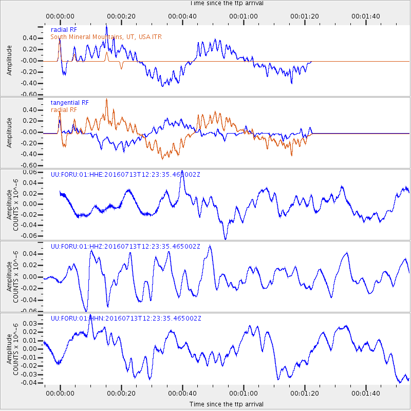
Signal To Noise
| Channel | StoN | STA | LTA |
| UU:FORU:01:HHZ:20160713T12:23:35.465002Z | 2.132999 | 1.2740049E-8 | 5.9728342E-9 |
| UU:FORU:01:HHN:20160713T12:23:35.465002Z | 0.64223623 | 1.2893623E-8 | 2.0076138E-8 |
| UU:FORU:01:HHE:20160713T12:23:35.465002Z | 1.0615451 | 1.5335191E-8 | 1.4446103E-8 |
| Arrivals |
| Ps | |
| PpPs | |
| PsPs/PpSs | |


