You are here: Home > Network List > TA - USArray Transportable Network (new EarthScope stations) Stations List
> Station A21K Barrow, AK, USA > Earthquake Result Viewer
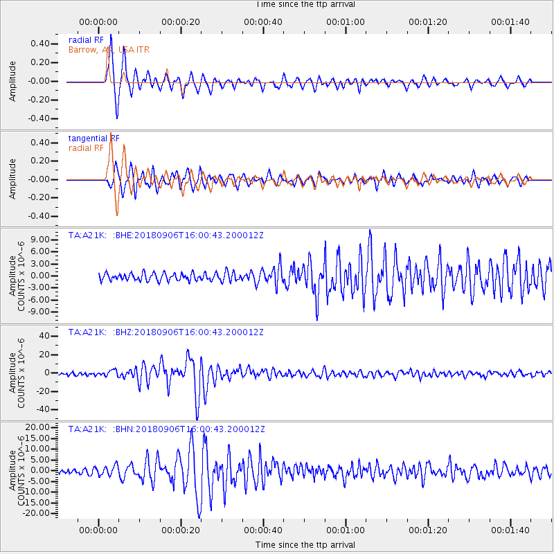
A21K Barrow, AK, USA - Earthquake Result Viewer
*The percent match for this event was below the threshold and hence no stack was calculated.
| Earthquake location: |
Fiji Islands |
| Earthquake latitude/longitude: |
-18.4/179.5 |
| Earthquake time(UTC): |
2018/09/06 (249) 15:49:17 GMT |
| Earthquake Depth: |
669 km |
| Earthquake Magnitude: |
8.1 Mi |
| Earthquake Catalog/Contributor: |
NEIC PDE/at |
|
| Network: |
TA USArray Transportable Network (new EarthScope stations) |
| Station: |
A21K Barrow, AK, USA |
| Lat/Lon: |
71.32 N/156.62 W |
| Elevation: |
577 m |
|
| Distance: |
91.0 deg |
| Az: |
7.496 deg |
| Baz: |
202.611 deg |
| Ray Param: |
$rayparam |
*The percent match for this event was below the threshold and hence was not used in the summary stack. |
|
| Radial Match: |
94.68968 % |
| Radial Bump: |
400 |
| Transverse Match: |
93.13377 % |
| Transverse Bump: |
400 |
| SOD ConfigId: |
13570011 |
| Insert Time: |
2019-05-01 03:23:51.378 +0000 |
| GWidth: |
2.5 |
| Max Bumps: |
400 |
| Tol: |
0.001 |
|
Signal To Noise
| Channel | StoN | STA | LTA |
| TA:A21K: :BHZ:20180906T16:00:43.200012Z | 2.6918168 | 3.1799693E-6 | 1.1813469E-6 |
| TA:A21K: :BHN:20180906T16:00:43.200012Z | 2.203203 | 2.282145E-6 | 1.0358306E-6 |
| TA:A21K: :BHE:20180906T16:00:43.200012Z | 1.3079504 | 1.1327218E-6 | 8.660281E-7 |
| Arrivals |
| Ps | |
| PpPs | |
| PsPs/PpSs | |


