You are here: Home > Network List > TA - USArray Transportable Network (new EarthScope stations) Stations List
> Station I30M Mount Dempster, Yukon, CAN > Earthquake Result Viewer
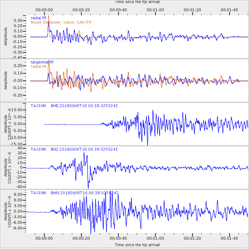
I30M Mount Dempster, Yukon, CAN - Earthquake Result Viewer
*The percent match for this event was below the threshold and hence no stack was calculated.
| Earthquake location: |
Fiji Islands |
| Earthquake latitude/longitude: |
-18.4/179.5 |
| Earthquake time(UTC): |
2018/09/06 (249) 15:49:17 GMT |
| Earthquake Depth: |
669 km |
| Earthquake Magnitude: |
8.1 Mi |
| Earthquake Catalog/Contributor: |
NEIC PDE/at |
|
| Network: |
TA USArray Transportable Network (new EarthScope stations) |
| Station: |
I30M Mount Dempster, Yukon, CAN |
| Lat/Lon: |
65.22 N/136.38 W |
| Elevation: |
1399 m |
|
| Distance: |
89.8 deg |
| Az: |
17.061 deg |
| Baz: |
221.38 deg |
| Ray Param: |
$rayparam |
*The percent match for this event was below the threshold and hence was not used in the summary stack. |
|
| Radial Match: |
91.932724 % |
| Radial Bump: |
400 |
| Transverse Match: |
85.81346 % |
| Transverse Bump: |
400 |
| SOD ConfigId: |
13570011 |
| Insert Time: |
2019-05-01 03:24:53.966 +0000 |
| GWidth: |
2.5 |
| Max Bumps: |
400 |
| Tol: |
0.001 |
|
Signal To Noise
| Channel | StoN | STA | LTA |
| TA:I30M: :BHZ:20180906T16:00:38.025024Z | 14.642172 | 2.1087114E-6 | 1.4401631E-7 |
| TA:I30M: :BHN:20180906T16:00:38.025024Z | 6.2019057 | 3.7342429E-7 | 6.0211214E-8 |
| TA:I30M: :BHE:20180906T16:00:38.025024Z | 6.9955726 | 4.0892064E-7 | 5.8454205E-8 |
| Arrivals |
| Ps | |
| PpPs | |
| PsPs/PpSs | |


