You are here: Home > Network List > GS - US Geological Survey Networks Stations List
> Station KAN08 Pence Farm, Harper, KS, USA > Earthquake Result Viewer
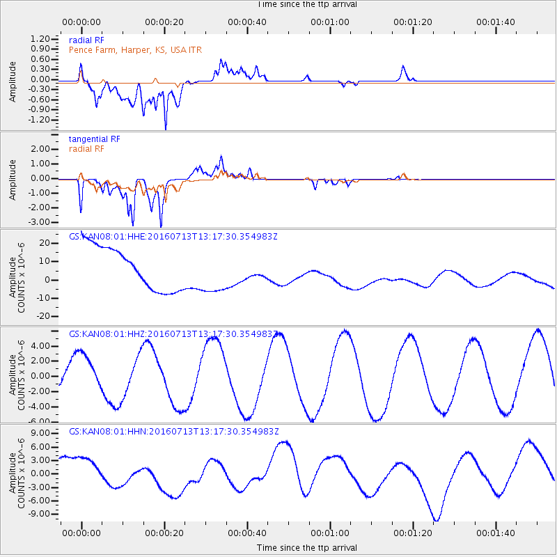
KAN08 Pence Farm, Harper, KS, USA - Earthquake Result Viewer
*The percent match for this event was below the threshold and hence no stack was calculated.
| Earthquake location: |
Kermadec Islands Region |
| Earthquake latitude/longitude: |
-27.9/-176.5 |
| Earthquake time(UTC): |
2016/07/13 (195) 13:04:25 GMT |
| Earthquake Depth: |
10 km |
| Earthquake Magnitude: |
5.7 MB |
| Earthquake Catalog/Contributor: |
NEIC PDE/NEIC COMCAT |
|
| Network: |
GS US Geological Survey Networks |
| Station: |
KAN08 Pence Farm, Harper, KS, USA |
| Lat/Lon: |
37.23 N/97.97 W |
| Elevation: |
375 m |
|
| Distance: |
98.1 deg |
| Az: |
52.195 deg |
| Baz: |
241.129 deg |
| Ray Param: |
$rayparam |
*The percent match for this event was below the threshold and hence was not used in the summary stack. |
|
| Radial Match: |
86.57681 % |
| Radial Bump: |
400 |
| Transverse Match: |
88.69664 % |
| Transverse Bump: |
400 |
| SOD ConfigId: |
1634031 |
| Insert Time: |
2016-07-27 13:05:05.324 +0000 |
| GWidth: |
2.5 |
| Max Bumps: |
400 |
| Tol: |
0.001 |
|
Signal To Noise
| Channel | StoN | STA | LTA |
| GS:KAN08:01:HHZ:20160713T13:17:30.354983Z | 1.8728081 | 2.6579246E-6 | 1.4192188E-6 |
| GS:KAN08:01:HHN:20160713T13:17:30.354983Z | 0.6052417 | 6.5569734E-6 | 1.0833644E-5 |
| GS:KAN08:01:HHE:20160713T13:17:30.354983Z | 1.087753 | 1.2552157E-5 | 1.1539529E-5 |
| Arrivals |
| Ps | |
| PpPs | |
| PsPs/PpSs | |


