You are here: Home > Network List > TA - USArray Transportable Network (new EarthScope stations) Stations List
> Station M31M Drury Creek, Yukon, CA > Earthquake Result Viewer
M31M Drury Creek, Yukon, CA - Earthquake Result Viewer
*The percent match for this event was below the threshold and hence no stack was calculated.
| Earthquake location: |
Fiji Islands |
| Earthquake latitude/longitude: |
-18.4/179.5 |
| Earthquake time(UTC): |
2018/09/06 (249) 15:49:17 GMT |
| Earthquake Depth: |
669 km |
| Earthquake Magnitude: |
8.1 Mi |
| Earthquake Catalog/Contributor: |
NEIC PDE/at |
|
| Network: |
TA USArray Transportable Network (new EarthScope stations) |
| Station: |
M31M Drury Creek, Yukon, CA |
| Lat/Lon: |
62.20 N/134.39 W |
| Elevation: |
639 m |
|
| Distance: |
88.2 deg |
| Az: |
19.756 deg |
| Baz: |
223.205 deg |
| Ray Param: |
$rayparam |
*The percent match for this event was below the threshold and hence was not used in the summary stack. |
|
| Radial Match: |
83.47439 % |
| Radial Bump: |
400 |
| Transverse Match: |
84.79338 % |
| Transverse Bump: |
400 |
| SOD ConfigId: |
13570011 |
| Insert Time: |
2019-05-01 03:25:26.349 +0000 |
| GWidth: |
2.5 |
| Max Bumps: |
400 |
| Tol: |
0.001 |
|
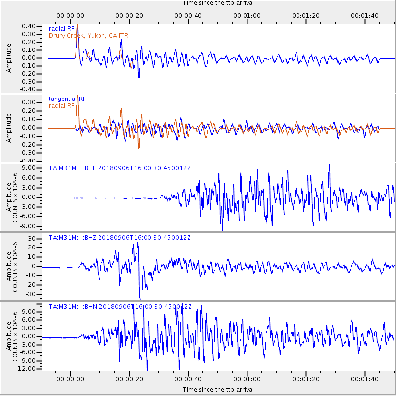
Signal To Noise
| Channel | StoN | STA | LTA |
| TA:M31M: :BHZ:20180906T16:00:30.450012Z | 13.747499 | 1.8920384E-6 | 1.3762782E-7 |
| TA:M31M: :BHN:20180906T16:00:30.450012Z | 6.255261 | 3.617944E-7 | 5.7838417E-8 |
| TA:M31M: :BHE:20180906T16:00:30.450012Z | 5.7391863 | 3.9517826E-7 | 6.885615E-8 |
| Arrivals |
| Ps | |
| PpPs | |
| PsPs/PpSs | |


