You are here: Home > Network List > TA - USArray Transportable Network (new EarthScope stations) Stations List
> Station Q17K Contact Creek, Katmai, AK, USA > Earthquake Result Viewer
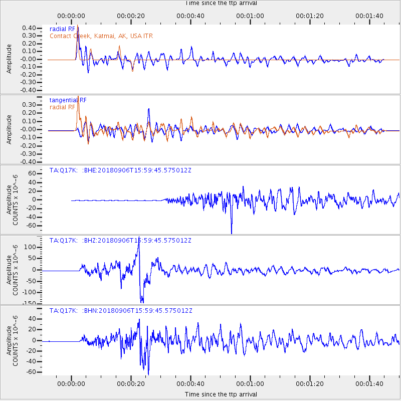
Q17K Contact Creek, Katmai, AK, USA - Earthquake Result Viewer
*The percent match for this event was below the threshold and hence no stack was calculated.
| Earthquake location: |
Fiji Islands |
| Earthquake latitude/longitude: |
-18.4/179.5 |
| Earthquake time(UTC): |
2018/09/06 (249) 15:49:17 GMT |
| Earthquake Depth: |
669 km |
| Earthquake Magnitude: |
8.1 Mi |
| Earthquake Catalog/Contributor: |
NEIC PDE/at |
|
| Network: |
TA USArray Transportable Network (new EarthScope stations) |
| Station: |
Q17K Contact Creek, Katmai, AK, USA |
| Lat/Lon: |
58.26 N/155.89 W |
| Elevation: |
1165 m |
|
| Distance: |
79.1 deg |
| Az: |
12.957 deg |
| Baz: |
203.753 deg |
| Ray Param: |
$rayparam |
*The percent match for this event was below the threshold and hence was not used in the summary stack. |
|
| Radial Match: |
96.47542 % |
| Radial Bump: |
400 |
| Transverse Match: |
92.317245 % |
| Transverse Bump: |
400 |
| SOD ConfigId: |
13570011 |
| Insert Time: |
2019-05-01 03:25:55.008 +0000 |
| GWidth: |
2.5 |
| Max Bumps: |
400 |
| Tol: |
0.001 |
|
Signal To Noise
| Channel | StoN | STA | LTA |
| TA:Q17K: :BHZ:20180906T15:59:45.575012Z | 41.00934 | 9.776332E-6 | 2.3839283E-7 |
| TA:Q17K: :BHN:20180906T15:59:45.575012Z | 17.476654 | 3.3510955E-6 | 1.9174698E-7 |
| TA:Q17K: :BHE:20180906T15:59:45.575012Z | 11.231154 | 1.7357654E-6 | 1.5454916E-7 |
| Arrivals |
| Ps | |
| PpPs | |
| PsPs/PpSs | |


