You are here: Home > Network List > US - United States National Seismic Network Stations List
> Station HAWA Hanford, Washington, USA > Earthquake Result Viewer
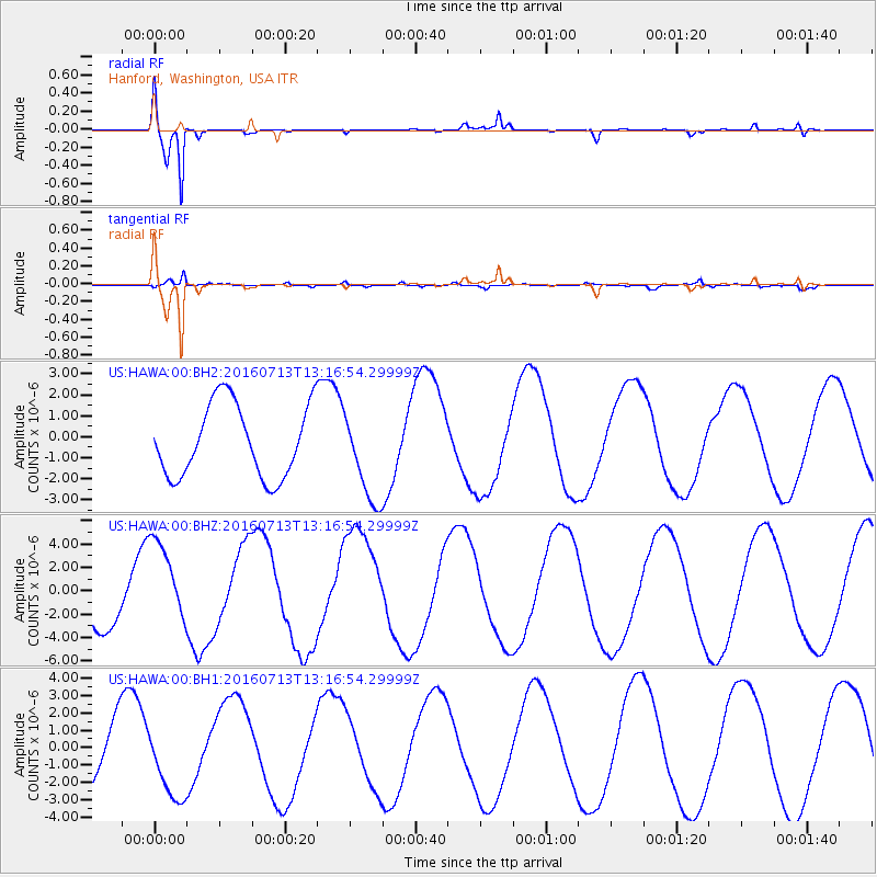
HAWA Hanford, Washington, USA - Earthquake Result Viewer
*The percent match for this event was below the threshold and hence no stack was calculated.
| Earthquake location: |
Kermadec Islands Region |
| Earthquake latitude/longitude: |
-27.9/-176.5 |
| Earthquake time(UTC): |
2016/07/13 (195) 13:04:25 GMT |
| Earthquake Depth: |
10 km |
| Earthquake Magnitude: |
5.7 MB |
| Earthquake Catalog/Contributor: |
NEIC PDE/NEIC COMCAT |
|
| Network: |
US United States National Seismic Network |
| Station: |
HAWA Hanford, Washington, USA |
| Lat/Lon: |
46.39 N/119.53 W |
| Elevation: |
364 m |
|
| Distance: |
90.2 deg |
| Az: |
35.471 deg |
| Baz: |
227.879 deg |
| Ray Param: |
$rayparam |
*The percent match for this event was below the threshold and hence was not used in the summary stack. |
|
| Radial Match: |
96.063675 % |
| Radial Bump: |
373 |
| Transverse Match: |
79.112045 % |
| Transverse Bump: |
400 |
| SOD ConfigId: |
1634031 |
| Insert Time: |
2016-07-27 13:06:00.454 +0000 |
| GWidth: |
2.5 |
| Max Bumps: |
400 |
| Tol: |
0.001 |
|
Signal To Noise
| Channel | StoN | STA | LTA |
| US:HAWA:00:BHZ:20160713T13:16:54.29999Z | 1.7053297 | 3.6731828E-6 | 2.153943E-6 |
| US:HAWA:00:BH1:20160713T13:16:54.29999Z | 1.002196 | 2.0791374E-6 | 2.0745815E-6 |
| US:HAWA:00:BH2:20160713T13:16:54.29999Z | 1.2489156 | 2.1538247E-6 | 1.7245559E-6 |
| Arrivals |
| Ps | |
| PpPs | |
| PsPs/PpSs | |


