You are here: Home > Network List > TA - USArray Transportable Network (new EarthScope stations) Stations List
> Station K27A Flueckinger Farm, Gordon, NE, USA > Earthquake Result Viewer
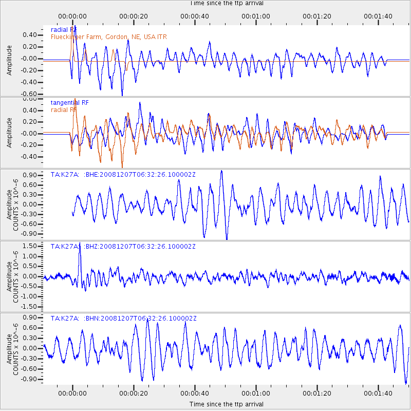
K27A Flueckinger Farm, Gordon, NE, USA - Earthquake Result Viewer
*The percent match for this event was below the threshold and hence no stack was calculated.
| Earthquake location: |
Northern Mid-Atlantic Ridge |
| Earthquake latitude/longitude: |
13.4/-44.8 |
| Earthquake time(UTC): |
2008/12/07 (342) 06:23:09 GMT |
| Earthquake Depth: |
10 km |
| Earthquake Magnitude: |
5.6 MB, 5.3 MS, 5.7 MW |
| Earthquake Catalog/Contributor: |
WHDF/NEIC |
|
| Network: |
TA USArray Transportable Network (new EarthScope stations) |
| Station: |
K27A Flueckinger Farm, Gordon, NE, USA |
| Lat/Lon: |
42.70 N/102.24 W |
| Elevation: |
1131 m |
|
| Distance: |
57.2 deg |
| Az: |
312.375 deg |
| Baz: |
102.721 deg |
| Ray Param: |
$rayparam |
*The percent match for this event was below the threshold and hence was not used in the summary stack. |
|
| Radial Match: |
73.05303 % |
| Radial Bump: |
400 |
| Transverse Match: |
61.26116 % |
| Transverse Bump: |
400 |
| SOD ConfigId: |
2658 |
| Insert Time: |
2010-03-06 15:22:04.911 +0000 |
| GWidth: |
2.5 |
| Max Bumps: |
400 |
| Tol: |
0.001 |
|
Signal To Noise
| Channel | StoN | STA | LTA |
| TA:K27A: :BHZ:20081207T06:32:26.100002Z | 5.1299596 | 5.6164015E-7 | 1.0948237E-7 |
| TA:K27A: :BHN:20081207T06:32:26.100002Z | 1.7802962 | 2.963683E-7 | 1.6647135E-7 |
| TA:K27A: :BHE:20081207T06:32:26.100002Z | 1.123767 | 2.8288966E-7 | 2.5173338E-7 |
| Arrivals |
| Ps | |
| PpPs | |
| PsPs/PpSs | |


