You are here: Home > Network List > GS - US Geological Survey Networks Stations List
> Station OK043 N2390 and E0400 Rds, Waynoka, OK, USA > Earthquake Result Viewer
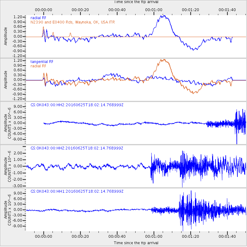
OK043 N2390 and E0400 Rds, Waynoka, OK, USA - Earthquake Result Viewer
*The percent match for this event was below the threshold and hence no stack was calculated.
| Earthquake location: |
Reykjanes Ridge |
| Earthquake latitude/longitude: |
53.9/-35.4 |
| Earthquake time(UTC): |
2016/06/25 (177) 17:54:19 GMT |
| Earthquake Depth: |
10 km |
| Earthquake Magnitude: |
5.5 MWC, 5.5 MWC |
| Earthquake Catalog/Contributor: |
NEIC PDE/NEIC COMCAT |
|
| Network: |
GS US Geological Survey Networks |
| Station: |
OK043 N2390 and E0400 Rds, Waynoka, OK, USA |
| Lat/Lon: |
36.43 N/98.75 W |
| Elevation: |
406 m |
|
| Distance: |
46.3 deg |
| Az: |
274.658 deg |
| Baz: |
47.006 deg |
| Ray Param: |
$rayparam |
*The percent match for this event was below the threshold and hence was not used in the summary stack. |
|
| Radial Match: |
66.842224 % |
| Radial Bump: |
400 |
| Transverse Match: |
33.664143 % |
| Transverse Bump: |
400 |
| SOD ConfigId: |
1634031 |
| Insert Time: |
2016-07-27 20:44:10.633 +0000 |
| GWidth: |
2.5 |
| Max Bumps: |
400 |
| Tol: |
0.001 |
|
Signal To Noise
| Channel | StoN | STA | LTA |
| GS:OK043:00:HHZ:20160625T18:02:14.768999Z | 1.2138699 | 2.8600041E-7 | 2.3561044E-7 |
| GS:OK043:00:HH1:20160625T18:02:14.768999Z | 0.53519094 | 3.4914228E-7 | 6.523696E-7 |
| GS:OK043:00:HH2:20160625T18:02:14.768999Z | 2.1602314 | 9.779986E-7 | 4.5272864E-7 |
| Arrivals |
| Ps | |
| PpPs | |
| PsPs/PpSs | |


