You are here: Home > Network List > AV - Alaska Volcano Observatory Stations List
> Station SPCR Ckakachatna River, Mount Spurr, Alaska > Earthquake Result Viewer
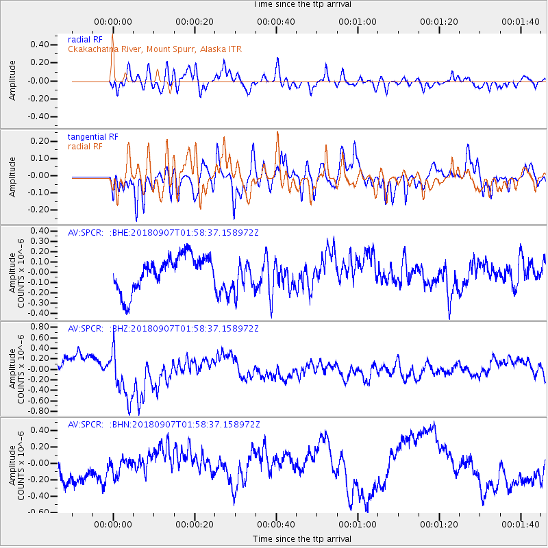
SPCR Ckakachatna River, Mount Spurr, Alaska - Earthquake Result Viewer
*The percent match for this event was below the threshold and hence no stack was calculated.
| Earthquake location: |
Panama-Colombia Border Region |
| Earthquake latitude/longitude: |
8.0/-77.6 |
| Earthquake time(UTC): |
2018/09/07 (250) 01:47:23 GMT |
| Earthquake Depth: |
10 km |
| Earthquake Magnitude: |
5.6 mb |
| Earthquake Catalog/Contributor: |
NEIC PDE/us |
|
| Network: |
AV Alaska Volcano Observatory |
| Station: |
SPCR Ckakachatna River, Mount Spurr, Alaska |
| Lat/Lon: |
61.20 N/152.21 W |
| Elevation: |
984 m |
|
| Distance: |
75.6 deg |
| Az: |
331.181 deg |
| Baz: |
99.67 deg |
| Ray Param: |
$rayparam |
*The percent match for this event was below the threshold and hence was not used in the summary stack. |
|
| Radial Match: |
58.6097 % |
| Radial Bump: |
400 |
| Transverse Match: |
71.13909 % |
| Transverse Bump: |
400 |
| SOD ConfigId: |
13570011 |
| Insert Time: |
2019-05-01 03:36:24.727 +0000 |
| GWidth: |
2.5 |
| Max Bumps: |
400 |
| Tol: |
0.001 |
|
Signal To Noise
| Channel | StoN | STA | LTA |
| AV:SPCR: :BHZ:20180907T01:58:37.158972Z | 2.9167087 | 4.8228367E-7 | 1.65352E-7 |
| AV:SPCR: :BHN:20180907T01:58:37.158972Z | 0.47153062 | 1.0268733E-7 | 2.1777447E-7 |
| AV:SPCR: :BHE:20180907T01:58:37.158972Z | 0.9084238 | 1.4759267E-7 | 1.6247117E-7 |
| Arrivals |
| Ps | |
| PpPs | |
| PsPs/PpSs | |


