You are here: Home > Network List > TA - USArray Transportable Network (new EarthScope stations) Stations List
> Station K27A Flueckinger Farm, Gordon, NE, USA > Earthquake Result Viewer
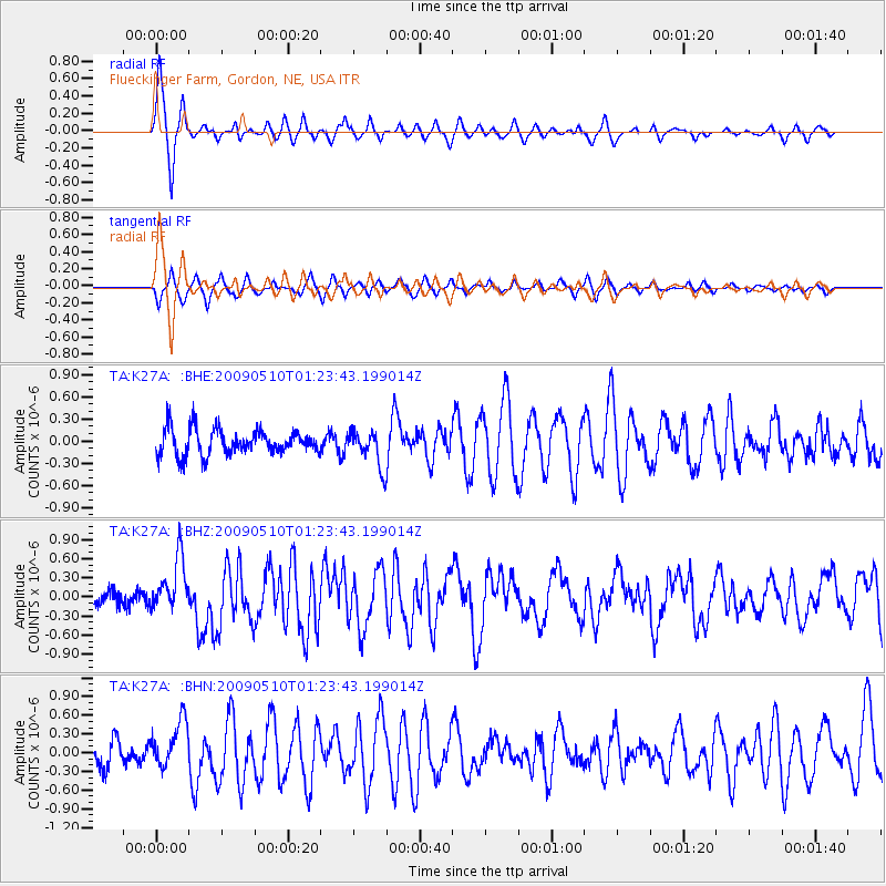
K27A Flueckinger Farm, Gordon, NE, USA - Earthquake Result Viewer
*The percent match for this event was below the threshold and hence no stack was calculated.
| Earthquake location: |
Off Coast Of Ecuador |
| Earthquake latitude/longitude: |
1.4/-85.2 |
| Earthquake time(UTC): |
2009/05/10 (130) 01:16:06 GMT |
| Earthquake Depth: |
6.0 km |
| Earthquake Magnitude: |
5.5 MB, 5.7 MS, 6.1 MW, 6.1 MW |
| Earthquake Catalog/Contributor: |
WHDF/NEIC |
|
| Network: |
TA USArray Transportable Network (new EarthScope stations) |
| Station: |
K27A Flueckinger Farm, Gordon, NE, USA |
| Lat/Lon: |
42.70 N/102.24 W |
| Elevation: |
1131 m |
|
| Distance: |
43.9 deg |
| Az: |
341.813 deg |
| Baz: |
154.957 deg |
| Ray Param: |
$rayparam |
*The percent match for this event was below the threshold and hence was not used in the summary stack. |
|
| Radial Match: |
78.94973 % |
| Radial Bump: |
301 |
| Transverse Match: |
70.13253 % |
| Transverse Bump: |
388 |
| SOD ConfigId: |
2760 |
| Insert Time: |
2010-03-06 15:22:28.097 +0000 |
| GWidth: |
2.5 |
| Max Bumps: |
400 |
| Tol: |
0.001 |
|
Signal To Noise
| Channel | StoN | STA | LTA |
| TA:K27A: :BHZ:20090510T01:23:43.199014Z | 3.2871876 | 4.2003526E-7 | 1.2777953E-7 |
| TA:K27A: :BHN:20090510T01:23:43.199014Z | 2.1301582 | 3.7097274E-7 | 1.7415267E-7 |
| TA:K27A: :BHE:20090510T01:23:43.199014Z | 1.4385971 | 2.4602912E-7 | 1.7102018E-7 |
| Arrivals |
| Ps | |
| PpPs | |
| PsPs/PpSs | |


