You are here: Home > Network List > CI - Caltech Regional Seismic Network Stations List
> Station MPM Manuel Prospect Mine, California, USA > Earthquake Result Viewer
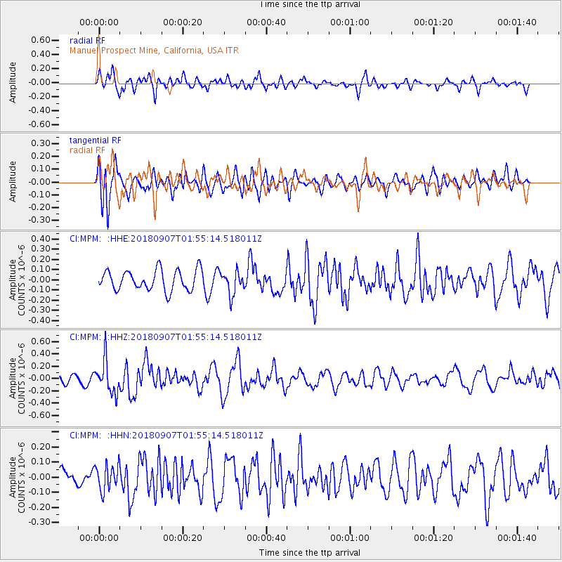
MPM Manuel Prospect Mine, California, USA - Earthquake Result Viewer
*The percent match for this event was below the threshold and hence no stack was calculated.
| Earthquake location: |
Panama-Colombia Border Region |
| Earthquake latitude/longitude: |
8.0/-77.6 |
| Earthquake time(UTC): |
2018/09/07 (250) 01:47:23 GMT |
| Earthquake Depth: |
10 km |
| Earthquake Magnitude: |
5.6 mb |
| Earthquake Catalog/Contributor: |
NEIC PDE/us |
|
| Network: |
CI Caltech Regional Seismic Network |
| Station: |
MPM Manuel Prospect Mine, California, USA |
| Lat/Lon: |
36.06 N/117.49 W |
| Elevation: |
185 m |
|
| Distance: |
45.8 deg |
| Az: |
313.546 deg |
| Baz: |
117.647 deg |
| Ray Param: |
$rayparam |
*The percent match for this event was below the threshold and hence was not used in the summary stack. |
|
| Radial Match: |
59.754406 % |
| Radial Bump: |
400 |
| Transverse Match: |
77.307884 % |
| Transverse Bump: |
400 |
| SOD ConfigId: |
13570011 |
| Insert Time: |
2019-05-01 03:37:56.398 +0000 |
| GWidth: |
2.5 |
| Max Bumps: |
400 |
| Tol: |
0.001 |
|
Signal To Noise
| Channel | StoN | STA | LTA |
| CI:MPM: :HHZ:20180907T01:55:14.518011Z | 2.6012368 | 2.7308718E-7 | 1.0498359E-7 |
| CI:MPM: :HHN:20180907T01:55:14.518011Z | 0.8209385 | 8.45356E-8 | 1.0297433E-7 |
| CI:MPM: :HHE:20180907T01:55:14.518011Z | 1.1510203 | 1.1352892E-7 | 9.863329E-8 |
| Arrivals |
| Ps | |
| PpPs | |
| PsPs/PpSs | |


