You are here: Home > Network List > US - United States National Seismic Network Stations List
> Station DUG Dugway, Tooele County, Utah, USA > Earthquake Result Viewer
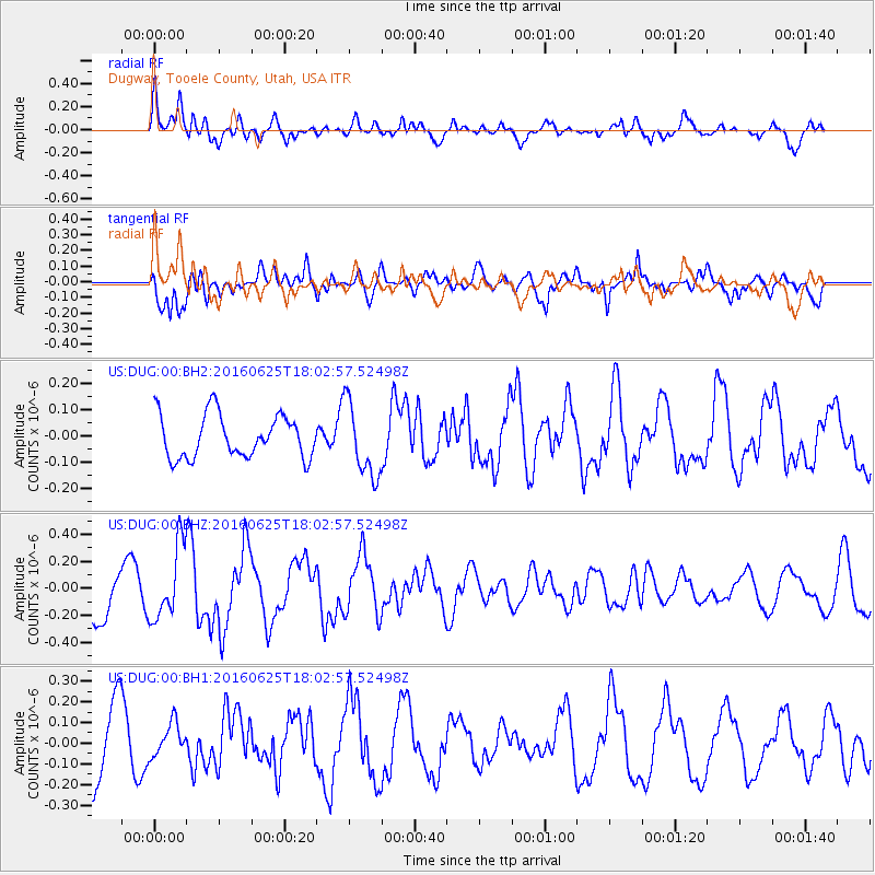
DUG Dugway, Tooele County, Utah, USA - Earthquake Result Viewer
*The percent match for this event was below the threshold and hence no stack was calculated.
| Earthquake location: |
Reykjanes Ridge |
| Earthquake latitude/longitude: |
53.9/-35.4 |
| Earthquake time(UTC): |
2016/06/25 (177) 17:54:19 GMT |
| Earthquake Depth: |
10 km |
| Earthquake Magnitude: |
5.5 MWC, 5.5 MWC |
| Earthquake Catalog/Contributor: |
NEIC PDE/NEIC COMCAT |
|
| Network: |
US United States National Seismic Network |
| Station: |
DUG Dugway, Tooele County, Utah, USA |
| Lat/Lon: |
40.19 N/112.81 W |
| Elevation: |
1477 m |
|
| Distance: |
51.9 deg |
| Az: |
288.235 deg |
| Baz: |
47.207 deg |
| Ray Param: |
$rayparam |
*The percent match for this event was below the threshold and hence was not used in the summary stack. |
|
| Radial Match: |
59.87043 % |
| Radial Bump: |
400 |
| Transverse Match: |
76.34708 % |
| Transverse Bump: |
400 |
| SOD ConfigId: |
1634031 |
| Insert Time: |
2016-07-27 20:47:43.129 +0000 |
| GWidth: |
2.5 |
| Max Bumps: |
400 |
| Tol: |
0.001 |
|
Signal To Noise
| Channel | StoN | STA | LTA |
| US:DUG:00:BHZ:20160625T18:02:57.52498Z | 1.821929 | 2.6990372E-7 | 1.4814174E-7 |
| US:DUG:00:BH1:20160625T18:02:57.52498Z | 0.54843956 | 7.950433E-8 | 1.4496462E-7 |
| US:DUG:00:BH2:20160625T18:02:57.52498Z | 1.7285805 | 1.4092198E-7 | 8.1524696E-8 |
| Arrivals |
| Ps | |
| PpPs | |
| PsPs/PpSs | |


