You are here: Home > Network List > US - United States National Seismic Network Stations List
> Station EGMT Eagleton, Montana, USA > Earthquake Result Viewer
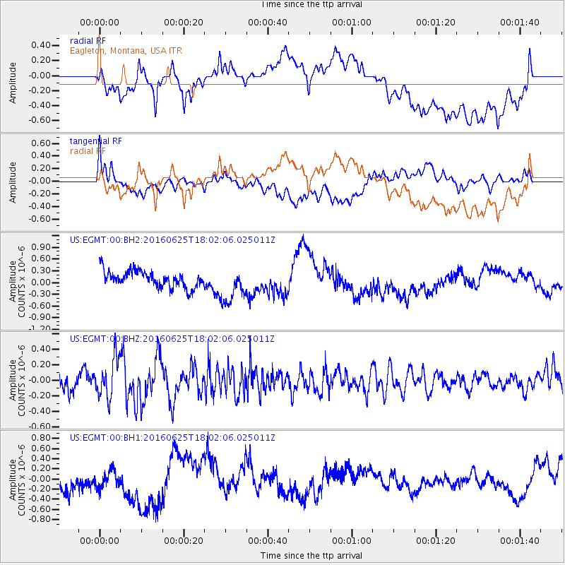
EGMT Eagleton, Montana, USA - Earthquake Result Viewer
*The percent match for this event was below the threshold and hence no stack was calculated.
| Earthquake location: |
Reykjanes Ridge |
| Earthquake latitude/longitude: |
53.9/-35.4 |
| Earthquake time(UTC): |
2016/06/25 (177) 17:54:19 GMT |
| Earthquake Depth: |
10 km |
| Earthquake Magnitude: |
5.5 MWC, 5.5 MWC |
| Earthquake Catalog/Contributor: |
NEIC PDE/NEIC COMCAT |
|
| Network: |
US United States National Seismic Network |
| Station: |
EGMT Eagleton, Montana, USA |
| Lat/Lon: |
48.02 N/109.75 W |
| Elevation: |
1055 m |
|
| Distance: |
45.2 deg |
| Az: |
294.385 deg |
| Baz: |
53.412 deg |
| Ray Param: |
$rayparam |
*The percent match for this event was below the threshold and hence was not used in the summary stack. |
|
| Radial Match: |
32.264126 % |
| Radial Bump: |
400 |
| Transverse Match: |
43.02532 % |
| Transverse Bump: |
400 |
| SOD ConfigId: |
1634031 |
| Insert Time: |
2016-07-27 20:47:46.478 +0000 |
| GWidth: |
2.5 |
| Max Bumps: |
400 |
| Tol: |
0.001 |
|
Signal To Noise
| Channel | StoN | STA | LTA |
| US:EGMT:00:BHZ:20160625T18:02:06.025011Z | 2.45082 | 2.645088E-7 | 1.07926645E-7 |
| US:EGMT:00:BH1:20160625T18:02:06.025011Z | 0.62957025 | 2.3874279E-7 | 3.7921546E-7 |
| US:EGMT:00:BH2:20160625T18:02:06.025011Z | 2.1904075 | 4.5940723E-7 | 2.0973596E-7 |
| Arrivals |
| Ps | |
| PpPs | |
| PsPs/PpSs | |


