You are here: Home > Network List > TA - USArray Transportable Network (new EarthScope stations) Stations List
> Station G21K Allakaket, AK, USA > Earthquake Result Viewer
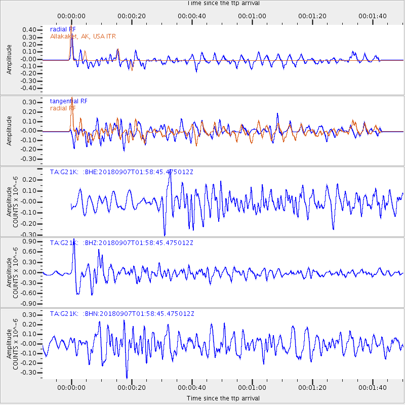
G21K Allakaket, AK, USA - Earthquake Result Viewer
*The percent match for this event was below the threshold and hence no stack was calculated.
| Earthquake location: |
Panama-Colombia Border Region |
| Earthquake latitude/longitude: |
8.0/-77.6 |
| Earthquake time(UTC): |
2018/09/07 (250) 01:47:23 GMT |
| Earthquake Depth: |
10 km |
| Earthquake Magnitude: |
5.6 mb |
| Earthquake Catalog/Contributor: |
NEIC PDE/us |
|
| Network: |
TA USArray Transportable Network (new EarthScope stations) |
| Station: |
G21K Allakaket, AK, USA |
| Lat/Lon: |
66.52 N/153.51 W |
| Elevation: |
446 m |
|
| Distance: |
77.1 deg |
| Az: |
336.495 deg |
| Baz: |
99.764 deg |
| Ray Param: |
$rayparam |
*The percent match for this event was below the threshold and hence was not used in the summary stack. |
|
| Radial Match: |
74.297585 % |
| Radial Bump: |
400 |
| Transverse Match: |
76.71236 % |
| Transverse Bump: |
400 |
| SOD ConfigId: |
13570011 |
| Insert Time: |
2019-05-01 03:43:58.456 +0000 |
| GWidth: |
2.5 |
| Max Bumps: |
400 |
| Tol: |
0.001 |
|
Signal To Noise
| Channel | StoN | STA | LTA |
| TA:G21K: :BHZ:20180907T01:58:45.475012Z | 7.4804325 | 4.0425664E-7 | 5.4041877E-8 |
| TA:G21K: :BHN:20180907T01:58:45.475012Z | 0.76347965 | 4.8599894E-8 | 6.365578E-8 |
| TA:G21K: :BHE:20180907T01:58:45.475012Z | 2.5971808 | 1.494899E-7 | 5.7558527E-8 |
| Arrivals |
| Ps | |
| PpPs | |
| PsPs/PpSs | |


