You are here: Home > Network List > TA - USArray Transportable Network (new EarthScope stations) Stations List
> Station O27A Beecher Island, Eckley, CO, USA > Earthquake Result Viewer
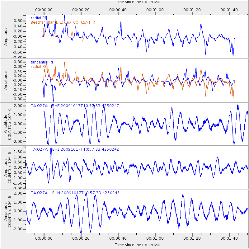
O27A Beecher Island, Eckley, CO, USA - Earthquake Result Viewer
*The percent match for this event was below the threshold and hence no stack was calculated.
| Earthquake location: |
Samoa Islands Region |
| Earthquake latitude/longitude: |
-16.4/-172.0 |
| Earthquake time(UTC): |
2009/10/17 (290) 10:45:26 GMT |
| Earthquake Depth: |
10 km |
| Earthquake Magnitude: |
5.7 MB, 5.3 MS, 5.7 MW, 5.7 MW |
| Earthquake Catalog/Contributor: |
WHDF/NEIC |
|
| Network: |
TA USArray Transportable Network (new EarthScope stations) |
| Station: |
O27A Beecher Island, Eckley, CO, USA |
| Lat/Lon: |
40.19 N/102.48 W |
| Elevation: |
1206 m |
|
| Distance: |
85.6 deg |
| Az: |
46.032 deg |
| Baz: |
244.416 deg |
| Ray Param: |
$rayparam |
*The percent match for this event was below the threshold and hence was not used in the summary stack. |
|
| Radial Match: |
48.203423 % |
| Radial Bump: |
314 |
| Transverse Match: |
61.322155 % |
| Transverse Bump: |
322 |
| SOD ConfigId: |
2622 |
| Insert Time: |
2010-03-06 15:24:52.124 +0000 |
| GWidth: |
2.5 |
| Max Bumps: |
400 |
| Tol: |
0.001 |
|
Signal To Noise
| Channel | StoN | STA | LTA |
| TA:O27A: :BHZ:20091017T10:57:33.425024Z | 2.31757 | 8.77204E-7 | 3.785016E-7 |
| TA:O27A: :BHN:20091017T10:57:33.425024Z | 0.20095083 | 3.0104235E-7 | 1.4980895E-6 |
| TA:O27A: :BHE:20091017T10:57:33.425024Z | 1.2772768 | 1.3934915E-6 | 1.0909864E-6 |
| Arrivals |
| Ps | |
| PpPs | |
| PsPs/PpSs | |


